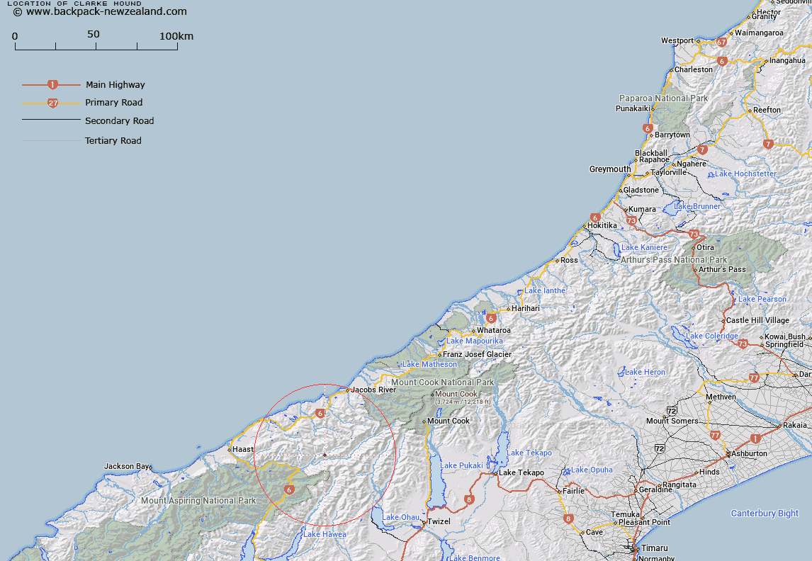
Map showing location of Clarke Mound


LINZ description: In Solution Range, height 1105 m, east of Haast. Topo50 map BY13 - Lake Paringa, GR 236 326.
Latitude: -43.908053
Longitude: 169.558287
Northing: 5132579.4
Easting: 1323631.4
Land District: Westland
Feat Type: Hill


Scroll down to see a more detailed road map and below that a topographical map showing the location of Clarke Mound. The road map has been supplied by openstreetmap and the topographical map of Clarke Mound has been supplied by Land Information New Zealand (LINZ).

Yes you can use the top static map for you school/university project or personal website with a link back. Contact me for any commercial use.

Clarke Mound Map New Zealand


New Zealand places in our database
[ A ] [ B ] [ C ] [ D ] [ E ] [ F ] [ G ] [ H ] [ I ] [ J ] [ K ] [ L ] [ M ] [ N ] [ O ] [ P ] [ Q ] [ R ] [ S ] [ T ] [ U ] [ V ] [ W ] [ X ] [ Y ] [ Z ]


Closest 20 Hills to Clarke Mound

Mount Napoleon ( 6.23km )   The Outpost ( 6.37km )   Rough Ridge ( 6.43km )   Square Top ( 6.62km )   Watkins Dome ( 6.71km )   Wills Peak ( 6.78km )   Mount Zeilian ( 6.94km )   Mount Chesney ( 6.97km )   Mount Solution ( 7.56km )   Mount Maitland ( 7.72km )   Snow Top ( 7.76km )   Low Spur ( 8.08km )   Shattered Peak ( 8.43km )   Mount Pearson ( 8.47km )   Shingle Top ( 8.5km )   Mount Marshman ( 8.61km )   Hassing Peak ( 8.67km )   Mount Giles ( 8.83km )   Adams Peak ( 9.13km )   Docherty Peak ( 9.3km )   Weary Summit ( 9.4km )   The Buttress ( 9.48km )   Eureka ( 9.67km )   Mount Awkward ( 9.69km )   Birch Knob ( 9.7km )   Mount McCullaugh ( 9.95km )   Monro Peak ( 10.2km )   Mount Wilson ( 10.29km )   Mount Greenfield ( 11.28km )   Lantern Peak ( 11.46km )   Mount Bull ( 11.63km )   Mount Tylee ( 11.73km )   Mount Holdsworth ( 11.95km )   Mount Strauchon ( 12.56km )   Mount Hooker ( 12.64km )   Plover Crag ( 12.65km )   Mount Jack ( 12.94km )   Power Knob ( 13.03km )   Mount Lakeman ( 13.12km )   Mount Millington ( 13.16km )