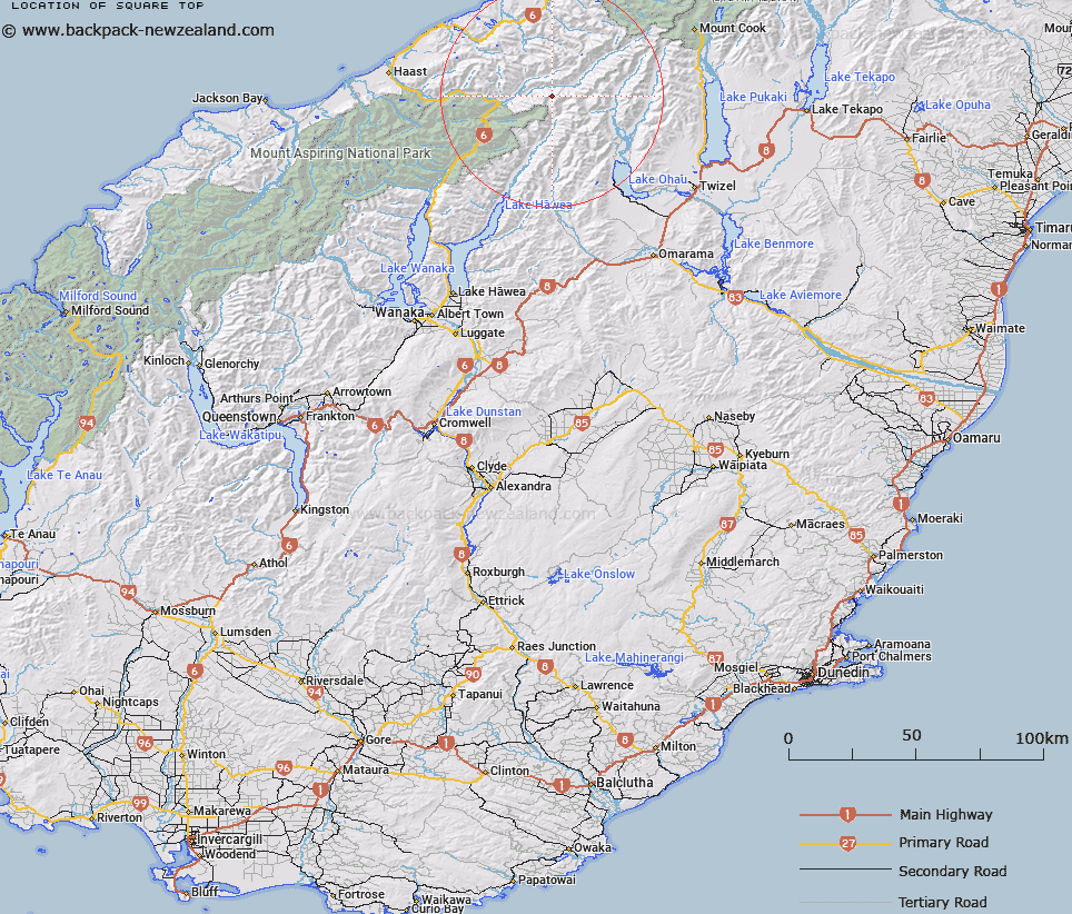
Map showing location of Square Top


LINZ description: Peak at the headwaters of the Hunter River West Branch and Larson Creek in the Southern Alps/Kā Tiritiri o te Moana. Between Mount Napoleon and Willis Peak.
Latitude: -43.957425
Longitude: 169.604496
Northing: 5127249.2
Easting: 1327567.9
Land District: Otago, Westland
Feat Type: Hill


Scroll down to see a more detailed road map and below that a topographical map showing the location of Square Top. The road map has been supplied by openstreetmap and the topographical map of Square Top has been supplied by Land Information New Zealand (LINZ).

Yes you can use the top static map for you school/university project or personal website with a link back. Contact me for any commercial use.

Square Top Map New Zealand


New Zealand places in our database
[ A ] [ B ] [ C ] [ D ] [ E ] [ F ] [ G ] [ H ] [ I ] [ J ] [ K ] [ L ] [ M ] [ N ] [ O ] [ P ] [ Q ] [ R ] [ S ] [ T ] [ U ] [ V ] [ W ] [ X ] [ Y ] [ Z ]


Closest 20 Hills to Square Top

Wills Peak ( 0.33km )   Mount Napoleon ( 0.82km )   Mount Maitland ( 1.6km )   Watkins Dome ( 1.67km )   Mount Pearson ( 2.27km )   Snow Top ( 2.53km )   Mount Giles ( 2.77km )   Adams Peak ( 3.47km )   Docherty Peak ( 3.74km )   Hassing Peak ( 3.75km )   Mount Marshman ( 4.17km )   Mount Wilson ( 5.15km )   Mount Greenfield ( 5.58km )   Shingle Top ( 5.71km )   Mount Tylee ( 6.02km )   Mount Holdsworth ( 6.27km )   Clarke Mound ( 6.62km )   Clarkes Mound ( 6.62km )   Mount Awkward ( 6.99km )   Mount Strauchon ( 7.38km )   Mount Solution ( 7.9km )   Mount Enderby ( 9.02km )   Mount McKenzie ( 9.54km )   Mount Mackenzie ( 9.54km )   Mount Bull ( 9.56km )   Anita Peak ( 9.81km )   Mount Hammerack ( 10.48km )   Protuberance Peak ( 11.09km )   The Outpost ( 11.34km )   Mount Lakeman ( 11.5km )   College Peak ( 11.6km )   Mount Trent ( 11.66km )   Soloist Peak ( 11.94km )   Stevenson Peak ( 11.95km )   Mount Earle ( 12.43km )   Birch Knob ( 12.44km )   Mount Fraser ( 12.58km )   Mount Dobson ( 12.85km )   Mount Ferguson ( 12.86km )   Mount Chesney ( 12.87km )