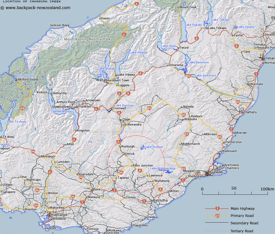
Map showing location of Canadian Creek


LINZ description: A left bank tributary of the Clutha River, joining it 4km South-east of Craig Hill. Beaumont Survey District.
Latitude: -45.764843
Longitude: 169.533037
Northing: 4926232.1
Easting: 1330414.3
Land District: Otago
Feat Type: Stream


Scroll down to see a more detailed road map and below that a topographical map showing the location of Canadian Creek. The road map has been supplied by openstreetmap and the topographical map of Canadian Creek has been supplied by Land Information New Zealand (LINZ).

Yes you can use the top static map for you school/university project or personal website with a link back. Contact me for any commercial use.

Canadian Creek Map New Zealand


New Zealand places in our database
[ A ] [ B ] [ C ] [ D ] [ E ] [ F ] [ G ] [ H ] [ I ] [ J ] [ K ] [ L ] [ M ] [ N ] [ O ] [ P ] [ Q ] [ R ] [ S ] [ T ] [ U ] [ V ] [ W ] [ X ] [ Y ] [ Z ]


Closest 20 Streams to Canadian Creek

Canadian Creek ( 0km )   Back Creek ( 2.76km )   Craig Creek ( 4.04km )   Fruid Burn ( 4.35km )   Diggers Stream ( 4.52km )   Little Beaumont Stream ( 4.9km )   Beaumont River ( 4.92km )   Little Minzion Burn ( 5.16km )   Low Burn ( 6.81km )   Black Stream ( 6.91km )   Belle Burn ( 7.47km )   Moffats Stream ( 7.51km )   Black Cat Creek ( 7.69km )   Talla Burn ( 7.77km )   Falls Creek ( 8.85km )   Medwins Creek ( 8.95km )   Gibsons Creek ( 9.4km )   Bowlers Creek ( 10.97km )   Carsons Creek ( 11.32km )   Camp Creek ( 12.68km )   Judge Creek ( 12.92km )   Minzion Burn ( 13.48km )   Deep Creek ( 14.48km )   Jimmys Creek ( 14.59km )   Oven Hill Creek ( 15.65km )   Swirl Burn ( 15.74km )   Benger Burn (South Branch) ( 16.72km )   Armstrongs Creek ( 16.77km )   Blackcleugh Burn ( 17.52km )   Tima Burn ( 17.91km )   Anguilla Burn ( 18.16km )   Cameron Stream ( 18.17km )   MacKays Creek ( 18.2km )   Burnt Creek ( 18.59km )   Four Mile Creek ( 18.72km )   Stony Creek ( 18.73km )   Phantom Creek ( 18.83km )   Tuapeka Creek ( 18.99km )   Boundary Creek ( 19.2km )   Sherwood Stream ( 20.05km )