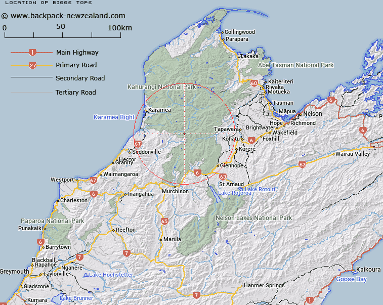
Map showing location of Biggs Tops


LINZ description: Feature shown on: NZMS260 M28 Edition 1 1987; NZTopo50-BQ23 498152
Latitude: -41.413056
Longitude: 172.399111
Northing: 5415214
Easting: 1549781
Land District: Nelson
Feat Type: Hill


Scroll down to see a more detailed road map and below that a topographical map showing the location of Biggs Tops. The road map has been supplied by openstreetmap and the topographical map of Biggs Tops has been supplied by Land Information New Zealand (LINZ).

Yes you can use the top static map for you school/university project or personal website with a link back. Contact me for any commercial use.

Biggs Tops Map New Zealand


New Zealand places in our database
[ A ] [ B ] [ C ] [ D ] [ E ] [ F ] [ G ] [ H ] [ I ] [ J ] [ K ] [ L ] [ M ] [ N ] [ O ] [ P ] [ Q ] [ R ] [ S ] [ T ] [ U ] [ V ] [ W ] [ X ] [ Y ] [ Z ]


Closest 20 Hills to Biggs Tops

Biggs Tops ( 0km )   Nugget Knob ( 3.44km )   Pike Peak ( 4.72km )   Mount Dean ( 4.92km )   Mount Kendall ( 5.58km )   Mount Luna ( 5.64km )   Mount Allen ( 6.77km )   Mount Joyce ( 8.6km )   Mount Patriarch ( 9.06km )   Mount Meyrick ( 9.29km )   Mount Brilliant ( 9.64km )   Mount Zetland ( 10.56km )   Mount Lester ( 10.6km )   Mount Gorgeous ( 12.99km )   Mount Fugel ( 13.37km )   Mount Baldy ( 13.54km )   Anaconda ( 13.66km )   Mount Radiant ( 13.76km )   Mount Scarlett ( 13.79km )   Mount Johnson ( 14.14km )   Marris Peak ( 15.27km )   Mount Gomorrah ( 15.99km )   Culliford Hill ( 16.08km )   Mount Sodom ( 16.35km )   Mount Young ( 16.48km )   Mount Webb ( 16.49km )   The Haystack ( 16.75km )   The Needle ( 16.91km )   Mount Baigent ( 17.4km )   The Haystack ( 17.46km )   Mount Olive ( 17.54km )   Mount Star ( 18.06km )   Marino Mountains ( 18.16km )   Billies Knob ( 18.27km )   Replica Hill ( 18.48km )   Sentinel Hill ( 18.57km )   Trent Peak ( 18.59km )   Mount Snodgrass ( 18.87km )   Devils Thumb ( 19.06km )   Mount Misery ( 19.09km )