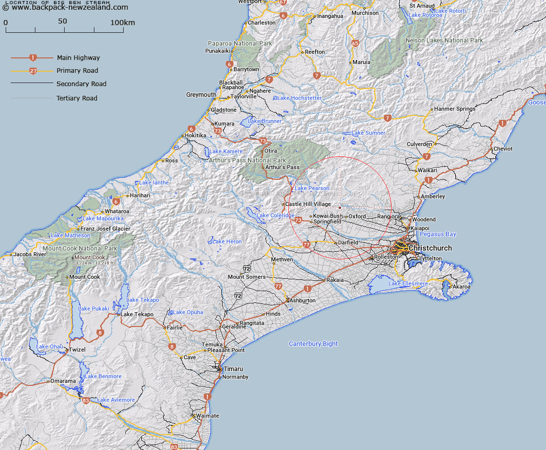
Map showing location of Big Ben Stream


LINZ description: Right bank tributary of Ashley River rising North-east of Big Ben Saddle, flowing North-eastward and joining Ashley River 2.75km West of Bottle Hill. Block III, Oxford Survey District.
Latitude: -43.232566
Longitude: 172.140399
Northing: 5213000
Easting: 1530200
Land District: Canterbury
Feat Type: Stream


Scroll down to see a more detailed road map and below that a topographical map showing the location of Big Ben Stream. The road map has been supplied by openstreetmap and the topographical map of Big Ben Stream has been supplied by Land Information New Zealand (LINZ).

Yes you can use the top static map for you school/university project or personal website with a link back. Contact me for any commercial use.

Big Ben Stream Map New Zealand


New Zealand places in our database
[ A ] [ B ] [ C ] [ D ] [ E ] [ F ] [ G ] [ H ] [ I ] [ J ] [ K ] [ L ] [ M ] [ N ] [ O ] [ P ] [ Q ] [ R ] [ S ] [ T ] [ U ] [ V ] [ W ] [ X ] [ Y ] [ Z ]


Closest 20 Streams to Big Ben Stream

Oxford Creek ( 1.22km )   Keats Stream ( 3.11km )   Billy Stream ( 3.17km )   East Branch Coopers Creek ( 3.71km )   West Branch Coopers Creek ( 5.53km )   Ladbrook Stream ( 5.71km )   Gammans Creek ( 5.73km )   Harman Stream ( 5.77km )   Canary Stream ( 5.84km )   Trout Stream ( 6.63km )   Richardson Stream ( 6.94km )   Moody Stream ( 6.94km )   Ellis Drain ( 7.12km )   Coopers Creek ( 7.12km )   Ashley Gorge Drain ( 7.26km )   Dog Leg Stream ( 7.31km )   Storm Stream ( 7.43km )   Mounseys Stream ( 7.5km )   Washpen Stream ( 7.5km )   Five Gully Stream ( 7.87km )   Cascade Stream ( 8.18km )   Dobson Stream ( 8.84km )   Shifton Stream ( 9.22km )   Dorman Stream ( 9.29km )   Glentui River ( 9.43km )   White Stream ( 9.84km )   Wharfedale Stream ( 9.93km )   Millton Stream ( 10.27km )   Eyre River ( 10.89km )   Townshend River ( 11.03km )   Milton Stream ( 11.03km )   Snowdale Stream ( 11.06km )   Bald Hills Stream ( 11.19km )   Coal Creek ( 11.86km )   Kingsdown Stream ( 12.11km )   Broom Stream ( 12.27km )   Washpool Stream ( 12.45km )   Foster Stream ( 12.78km )   Ribbonwood Stream ( 12.85km )   Garry River ( 13.01km )