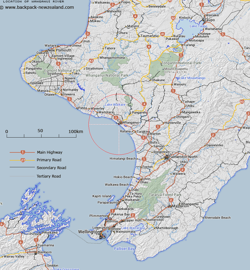
Map showing location of Wanganui River


LINZ description: Flows from W flank of Mt Tongariro to Tasman Sea at Wanganui City
Latitude: -39.951484
Longitude: 175.006481
Northing: 5575700
Easting: 1771400
Land District: Wellington
Feat Type: Stream


Scroll down to see a more detailed road map and below that a topographical map showing the location of Wanganui River. The road map has been supplied by openstreetmap and the topographical map of Wanganui River has been supplied by Land Information New Zealand (LINZ).

Yes you can use the top static map for you school/university project or personal website with a link back. Contact me for any commercial use.

Wanganui River Map New Zealand


New Zealand places in our database
[ A ] [ B ] [ C ] [ D ] [ E ] [ F ] [ G ] [ H ] [ I ] [ J ] [ K ] [ L ] [ M ] [ N ] [ O ] [ P ] [ Q ] [ R ] [ S ] [ T ] [ U ] [ V ] [ W ] [ X ] [ Y ] [ Z ]


Closest 20 Streams to Wanganui River

Kaitoke Stream ( 3.41km )   Waitahanui stream ( 5.17km )   Purua Stream ( 6.37km )   Matarawa Stream ( 6.68km )   Tutaeheka Stream ( 7.19km )   Mateongaonga Stream ( 8.85km )   Omapu Stream ( 9.89km )   Mowhanau Stream ( 10.62km )   Katikara Stream ( 11.32km )   Puketotara Stream ( 11.93km )   Tauraroa Stream ( 12.18km )   Kotiti Stream ( 12.21km )   Kukuta Stream ( 12.62km )   Kaukatea Stream ( 12.64km )   Mangaone Stream ( 12.68km )   Kaipua Stream ( 13.81km )   Okehu Stream ( 15.61km )   Karemu Stream ( 16.33km )   Mangamoku Stream ( 16.9km )   Makirikiri Stream ( 16.99km )   Mangatukituki Stream ( 17.36km )   Huritoia Stream ( 17.97km )   Turakina River ( 18.41km )   Mangaone Stream ( 18.84km )   Matatara Stream ( 18.9km )   Ototoka Stream ( 19.73km )   Ngaturi Stream ( 19.77km )   Makirikiri Stream ( 19.89km )   Upokongaro Stream ( 20km )   Mangaone Stream ( 20.39km )   Mangahoropiti Stream ( 20.82km )   Ruakorora Stream ( 21.09km )   Waiehu Stream ( 21.22km )   Mangotai Stream ( 21.44km )   Tatarongo Stream ( 21.51km )   Kaiwha Stream ( 21.92km )   Koitiata Stream ( 22.26km )   Waimatao Stream ( 22.4km )   Kahurauponga Creek ( 23.25km )   Mangaiti Stream ( 23.59km )