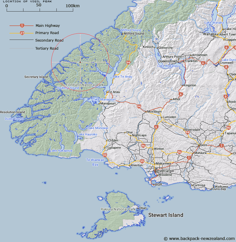
Map showing location of Vigil Peak


LINZ description: Approximately half-way between Lake Marchant and the south-west arm of George Sound. Feature shown on: NZTopo50-CC07 561979
Latitude: -45.033327
Longitude: 167.364124
Northing: 4997874.5
Easting: 1156065
Land District: Southland
Feat Type: Hill


Scroll down to see a more detailed road map and below that a topographical map showing the location of Vigil Peak. The road map has been supplied by openstreetmap and the topographical map of Vigil Peak has been supplied by Land Information New Zealand (LINZ).

Yes you can use the top static map for you school/university project or personal website with a link back. Contact me for any commercial use.

Vigil Peak Map New Zealand


New Zealand places in our database
[ A ] [ B ] [ C ] [ D ] [ E ] [ F ] [ G ] [ H ] [ I ] [ J ] [ K ] [ L ] [ M ] [ N ] [ O ] [ P ] [ Q ] [ R ] [ S ] [ T ] [ U ] [ V ] [ W ] [ X ] [ Y ] [ Z ]


Closest 20 Hills to Vigil Peak

Virgil Peak ( 0.5km )   The Knob Hill ( 1.59km )   Mary Peaks ( 3.41km )   Camp Hill ( 4.38km )   Spot Hill ( 4.67km )   Expedition Peak ( 4.9km )   Donald Mountain ( 5.42km )   Mount Donald ( 5.43km )   Saddle Hill ( 6km )   Christmas Hill ( 6.25km )   Mount Pluvius ( 8.17km )   Pluvius Mountain ( 8.17km )   West Peak Marguerite Peaks ( 8.55km )   West Peak ( 8.66km )   Mount Alexander ( 8.66km )   Fleetwood Peak ( 8.92km )   East Peak ( 9.22km )   East Peak Marguerite Peaks ( 9.24km )   Nita Peak ( 9.7km )   Mount Murrell ( 9.71km )   Middle Peak ( 10.79km )   Mount Henry ( 11.44km )   Coote Hill ( 12.02km )   Mount Elwood ( 12.76km )   Mount Pisgah ( 13.45km )   Mount Tanilba ( 14.37km )   Mount Caldwell ( 16.05km )   Mount Irene ( 16.08km )   Mount Elder ( 16.1km )   Mount Paulina ( 16.42km )   Victor Peak ( 17.18km )   Smith Peak ( 17.98km )   Mount Sydney Dacres ( 18.48km )   Overhead Cone ( 19.29km )   Double Peak ( 19.79km )   Woodcutters Peak ( 20.17km )   Saddle Back Peak ( 22.33km )   Command Peak ( 23.01km )   Rugged Peak ( 23.13km )   Coronation Peak ( 23.22km )