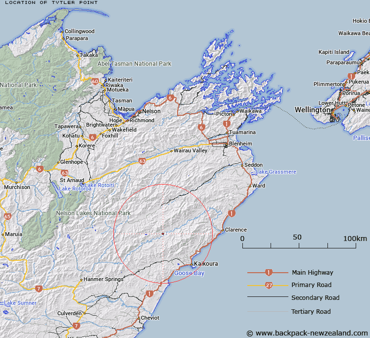
Map showing location of Tytler Point


LINZ description: Right angled bend on Clarence River just west of the Spray Stream confluence.
Latitude: -42.180521
Longitude: 173.464564
Northing: 5330075.9
Easting: 1638365.2
Land District: Marlborough
Feat Type: Point


Scroll down to see a more detailed road map and below that a topographical map showing the location of Tytler Point. The road map has been supplied by openstreetmap and the topographical map of Tytler Point has been supplied by Land Information New Zealand (LINZ).

Yes you can use the top static map for you school/university project or personal website with a link back. Contact me for any commercial use.

Tytler Point Map New Zealand


New Zealand places in our database
[ A ] [ B ] [ C ] [ D ] [ E ] [ F ] [ G ] [ H ] [ I ] [ J ] [ K ] [ L ] [ M ] [ N ] [ O ] [ P ] [ Q ] [ R ] [ S ] [ T ] [ U ] [ V ] [ W ] [ X ] [ Y ] [ Z ]


Closest 20 Points to Tytler Point

Te Ikawhataroa ( 28.13km )   Ohau Point ( 31.06km )   Paparoa Point ( 32.04km )   Atia Point ( 33.84km )   Point Kean ( 34.1km )   East Head ( 34.19km )   Spy Glass Point (Piripaua) ( 41.76km )   Willawa Point ( 53.2km )   Anniversary Point ( 63.34km )   Needles Point ( 67.1km )   Long Point ( 74.57km )   Point Gibson ( 78.8km )   Mussel Point ( 80.87km )   Cape Campbell ( 83.97km )   Martin Point ( 99.4km )   Wave Point ( 102.82km )   Mou Taku ( 102.86km )   Wai Kutakuta ( 104.05km )   Cullen Point ( 104.82km )   Okahoka Point ( 105km )   Grossi Point ( 106.67km )   Kaiuma Point ( 106.78km )   Robertson Point ( 107.17km )   Elephant Point ( 107.42km )   Matahua ( 107.43km )   Ocean Point ( 107.54km )   Momorangi Point ( 108.9km )   Iwituaroa Point ( 108.91km )   Black Point ( 109.4km )   Takaputira Point ( 109.42km )   Ngakutu Point ( 109.88km )   Whenuanui Point ( 110.24km )   Kaireperepe Point ( 110.49km )   Puroa Point ( 110.51km )   Kaipupu Point ( 110.6km )   Putanui Point ( 110.88km )   Separation Point ( 110.9km )   Okatiki Point ( 111km )   Houhou Point ( 111.19km )   Craggy Point ( 111.24km )