Map showing location of Tony Creek


LINZ description: Feature shown on: NZMS260 L27 Edition 1 1984; NZTopo50-BQ22 291234-242281
Latitude: -41.322139
Longitude: 172.127333
Northing: 5425114.2
Easting: 1526965.5
Land District: Nelson
Feat Type: Stream


Scroll down to see a more detailed road map and below that a topographical map showing the location of Tony Creek. The road map has been supplied by openstreetmap and the topographical map of Tony Creek has been supplied by Land Information New Zealand (LINZ).

Yes you can use the top static map for you school/university project or personal website with a link back. Contact me for any commercial use.
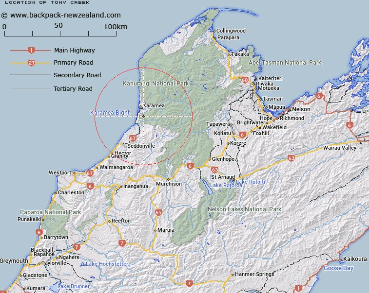
Tony Creek Map New Zealand


New Zealand places in our database
[ A ] [ B ] [ C ] [ D ] [ E ] [ F ] [ G ] [ H ] [ I ] [ J ] [ K ] [ L ] [ M ] [ N ] [ O ] [ P ] [ Q ] [ R ] [ S ] [ T ] [ U ] [ V ] [ W ] [ X ] [ Y ] [ Z ]


Closest 20 Streams to Tony Creek

Blackwater Creek ( 1.71km )   Mullocky Creek ( 2.13km )   ?t?mahana ( 3.11km )   Granite Creek ( 3.11km )   Egan Creek ( 3.58km )   Simkin Creek ( 4.17km )   Rocky Creek ( 4.94km )   Blatch Creek ( 5.1km )   Gillbank Creek ( 5.23km )   Kimberley Creek ( 5.29km )   Reef Creek ( 5.74km )   Jordan Creek ( 5.8km )   Hodge Creek ( 5.94km )   Little Wanganui River ( 6.37km )   Captain Creek ( 6.71km )   Rough Creek ( 6.98km )   Slaty Creek ( 6.99km )   Limestone Creek ( 7.71km )   Elford Creek ( 8.36km )   Pigeon Creek ( 8.46km )   Office Creek ( 8.92km )   Lawrence Stream ( 9.11km )   O'Connor Creek ( 9.3km )   Blue Duck Creek ( 9.36km )   Scarlett Creek ( 9.41km )   Baker Creek ( 9.45km )   Prince Creek ( 9.53km )   Blacktopp Creek ( 9.66km )   Drain Creek ( 9.72km )   Kelly Creek ( 9.84km )   Specimen Creek ( 10.34km )   Tidal Creek ( 11.02km )   Smith Creek ( 11.07km )   Ray Creek ( 11.1km )   Bellbird Stream ( 11.13km )   Harvey Creek ( 11.49km )   Webb Creek ( 11.49km )   MacPherson Creek ( 11.66km )   Copper Creek ( 11.68km )   Splinter Creek ( 11.73km )