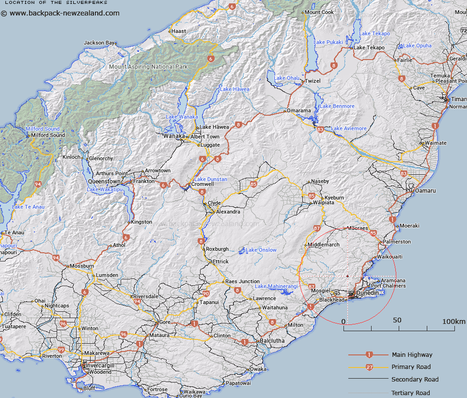
Map showing location of The Silverpeaks


LINZ description: Series of peaks oriented SW to NE roughly between GR1192 and GR1398. North of Dunedin, west of Waitati.
Latitude: -45.741141
Longitude: 170.451715
Northing: 4931554.5
Easting: 1401763.9
Land District: Otago
Feat Type: Range


Scroll down to see a more detailed road map and below that a topographical map showing the location of The Silverpeaks. The road map has been supplied by openstreetmap and the topographical map of The Silverpeaks has been supplied by Land Information New Zealand (LINZ).

Yes you can use the top static map for you school/university project or personal website with a link back. Contact me for any commercial use.

The Silverpeaks Map New Zealand


New Zealand places in our database
[ A ] [ B ] [ C ] [ D ] [ E ] [ F ] [ G ] [ H ] [ I ] [ J ] [ K ] [ L ] [ M ] [ N ] [ O ] [ P ] [ Q ] [ R ] [ S ] [ T ] [ U ] [ V ] [ W ] [ X ] [ Y ] [ Z ]


Closest 20 Ranges to The Silverpeaks

Chain Hills ( 16.99km )   Blue Mountains ( 43.5km )   Rock And Pillar Range ( 44.62km )   Razorback Range ( 45.71km )   Horse Range ( 50.03km )   Lammermoor Range ( 53.73km )   Lammerlaw Range ( 58.92km )   Kakanui Mountains ( 69.93km )   Pisgah Spur ( 76.69km )   Blue Mountains ( 87.07km )   Knobby Range ( 89.22km )   Crawford Hills ( 89.91km )   Raggedy Range ( 91.53km )   Ida Range ( 92.74km )   Idaburn Hills ( 95.11km )   Kaihiku Range ( 96.2km )   Magdalen Hills ( 101.51km )   Clare Hills ( 102.09km )   Merton Hills ( 102.2km )   The Nobbies ( 103.21km )   Stronach Range ( 104.5km )   Rata Range ( 105.24km )   Gidding Downs ( 105.95km )   Wisp Range ( 106.42km )   Old Man Range/Kopuwai ( 107.28km )   Old Man Range ( 107.28km )   Umbrella Mountains ( 107.67km )   Whitecoomb Range ( 107.69km )   Obelisk Range ( 109.16km )   Saint Marys Range ( 111.25km )   Beresford Range ( 111.37km )   Black Umbrella Range ( 112.18km )   Dunstan Mountains ( 113.77km )   Hawkdun Range ( 116.65km )   Cairnmuir Mountains ( 117.01km )   Old Woman Range ( 121.44km )   Round Downs ( 125.66km )   Maclennan Range ( 126.29km )   Saint Bathans Range ( 126.77km )   Garvie Mountains ( 128.29km )