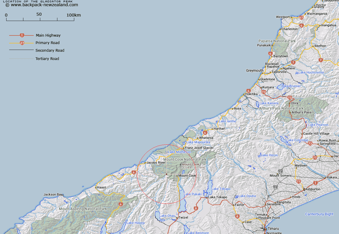
Map showing location of The Gladiator Peak


LINZ description: Shown on previous maps as Cairn IV
Latitude: -43.711334
Longitude: 169.961405
Northing: 5155700
Easting: 1355200
Land District: Westland
Feat Type: Hill


Scroll down to see a more detailed road map and below that a topographical map showing the location of The Gladiator Peak. The road map has been supplied by openstreetmap and the topographical map of The Gladiator Peak has been supplied by Land Information New Zealand (LINZ).

Yes you can use the top static map for you school/university project or personal website with a link back. Contact me for any commercial use.

The Gladiator Peak Map New Zealand


New Zealand places in our database
[ A ] [ B ] [ C ] [ D ] [ E ] [ F ] [ G ] [ H ] [ I ] [ J ] [ K ] [ L ] [ M ] [ N ] [ O ] [ P ] [ Q ] [ R ] [ S ] [ T ] [ U ] [ V ] [ W ] [ X ] [ Y ] [ Z ]


Closest 20 Hills to The Gladiator Peak

Mount Howitt ( 1.41km )   The Pommel ( 2.48km )   Blizzard Peak ( 3.93km )   Awatea Peak ( 4.02km )   Pioneer Peak ( 4.04km )   Mount Townsend ( 4.07km )   Mount Burns ( 4.2km )   Vampire ( 4.37km )   The Helmet ( 4.69km )   Mount Isabel ( 4.78km )   Watch Tower ( 4.96km )   Mount Thomson ( 4.97km )   Mount Thompson ( 4.97km )   Mount Bannie ( 4.98km )   Splinter Peak ( 5.13km )   Mount Eric ( 5.21km )   Sharks Teeth ( 5.22km )   Mount Montgomerie ( 5.33km )   Mount Montgomery ( 5.33km )   Scott Peak ( 5.44km )   Eagle Peak ( 5.51km )   Mount Stephen ( 5.61km )   Maunga Ma ( 5.64km )   Scissors ( 5.69km )   Notable Peak ( 5.79km )   Mount Brunner ( 5.91km )   Mount Glorious ( 6.26km )   Mount Peculiar ( 6.36km )   Mount Spence ( 6.52km )   Mount Mirk ( 6.7km )   Whitcombe Peak ( 7.01km )   Mount Foster ( 7.05km )   Mount Sefton ( 7.24km )   Mount Darby ( 7.27km )   MacKnob ( 7.75km )   Mount Marie ( 7.79km )   Mount Jeanette ( 8.03km )   Mount Massey ( 8.04km )   The Clue ( 8.3km )   Mount Jean ( 8.34km )