Map showing location of Tauranga


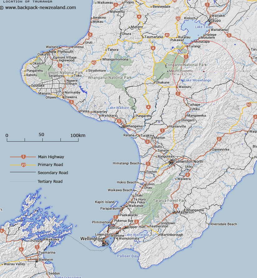
LINZ description: High point at 1065m in Kaimanawa State Forest by the confluence of the Mangamarie and the Rangitikei Rivers.
Latitude: -39.285244
Longitude: 176.010216
Northing: 5647248.1
Easting: 1859634
Land District: Wellington
Feat Type: Hill


Scroll down to see a more detailed road map and below that a topographical map showing the location of Tauranga. The road map has been supplied by openstreetmap and the topographical map of Tauranga has been supplied by Land Information New Zealand (LINZ).

Yes you can use the top static map for you school/university project or personal website with a link back. Contact me for any commercial use.

Tauranga Map New Zealand


New Zealand places in our database
[ A ] [ B ] [ C ] [ D ] [ E ] [ F ] [ G ] [ H ] [ I ] [ J ] [ K ] [ L ] [ M ] [ N ] [ O ] [ P ] [ Q ] [ R ] [ S ] [ T ] [ U ] [ V ] [ W ] [ X ] [ Y ] [ Z ]


Closest 20 Hills to Tauranga

Prominent Cone ( 3.35km )   Motumatai ( 4.34km )   Whakamarumaru ( 5.76km )   Te Apunga ( 7.11km )   Owhaoko ( 12.15km )   Otirirau ( 12.48km )   Otirau ( 12.48km )   Ngawhareangarua ( 12.73km )   Tikitiki ( 13.26km )   Te Piri ( 13.71km )   Karikaringa ( 13.86km )   Patutu ( 14.38km )   Motutere ( 14.5km )   Mount Azim ( 14.5km )   Makorako ( 14.57km )   Tutu Peak ( 14.86km )   Te Wetenga ( 15.55km )   Golden Hills ( 16.15km )   Makokomiko ( 16.16km )   Kaimanawa (Three Kings) ( 16.41km )   Manukaiapu ( 16.61km )   Waipahihi ( 16.79km )   Te Raketuangiangi ( 16.85km )   Te More ( 17.36km )   The Needles ( 17.46km )   Junction Top ( 17.49km )   Wakaari ( 17.56km )   Waingakia ( 17.59km )   Pukewharariki ( 17.63km )   Toatoa a Tamakaitangi ( 17.85km )   Mount Meany ( 18.04km )   Oheikura ( 18.09km )   Black Basin ( 18.18km )   Urchin ( 18.76km )   Tara o te Marama ( 18.78km )   Umukarikari ( 19.29km )   Sharp Cone ( 19.57km )   Mount Dowding ( 19.6km )   Mount Dowden ( 19.6km )   Te Ruatakaikare ( 19.66km )