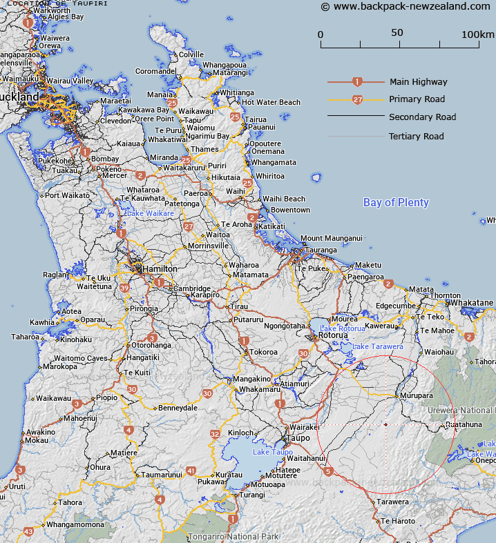
Map showing location of Taupiri
LINZ description: A prominent hill located approximately 8km north-west of Minginui township, and within the Whirinaki Te Pua-a-Tāne Conservation Park. NZTopo50 BG38-Wairapukao, GR 173 204. A beaconed geodetic mark, coded 1271, and a Fire Lookout are located at the summit.
Latitude: -38.608388
Longitude: 176.644226
Northing: 5720377.4
Easting: 1917339.8
Land District: South Auckland
Feat Type: Hill
Latitude: -38.608388
Longitude: 176.644226
Northing: 5720377.4
Easting: 1917339.8
Land District: South Auckland
Feat Type: Hill

Scroll down to see a more detailed road map and below that a topographical map showing the location of Taupiri. The road map has been supplied by openstreetmap and the topographical map of Taupiri has been supplied by Land Information New Zealand (LINZ).
Yes you can use the top static map for you school/university project or personal website with a link back. Contact me for any commercial use.
[ A ] [ B ] [ C ] [ D ] [ E ] [ F ] [ G ] [ H ] [ I ] [ J ] [ K ] [ L ] [ M ] [ N ] [ O ] [ P ] [ Q ] [ R ] [ S ] [ T ] [ U ] [ V ] [ W ] [ X ] [ Y ] [ Z ]