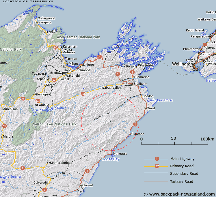
Map showing location of Tapuaenuku


LINZ description: Highest mountain on the Inland Kaikoura Range
Latitude: -41.995884
Longitude: 173.662822
Northing: 5350468.4
Easting: 1654897
Land District: Marlborough
Feat Type: Hill


Scroll down to see a more detailed road map and below that a topographical map showing the location of Tapuaenuku. The road map has been supplied by openstreetmap and the topographical map of Tapuaenuku has been supplied by Land Information New Zealand (LINZ).

Yes you can use the top static map for you school/university project or personal website with a link back. Contact me for any commercial use.

Tapuaenuku Map New Zealand


New Zealand places in our database
[ A ] [ B ] [ C ] [ D ] [ E ] [ F ] [ G ] [ H ] [ I ] [ J ] [ K ] [ L ] [ M ] [ N ] [ O ] [ P ] [ Q ] [ R ] [ S ] [ T ] [ U ] [ V ] [ W ] [ X ] [ Y ] [ Z ]


Closest 20 Hills to Tapuaenuku

Pinnacle ( 1.22km )   Crows Nest ( 2.03km )   Mount Alarm ( 2.56km )   The Bridge ( 4.25km )   Mitre Peak ( 4.5km )   Mount Gladstone ( 5.44km )   Division Hill ( 8.07km )   Gibraltar ( 8.09km )   Hodder ( 8.46km )   Mount Symons ( 8.72km )   Camden ( 9.46km )   Otterson ( 9.59km )   Mount Winterton ( 10.15km )   Limestone ( 10.53km )   Mount Cold ( 11.94km )   Mount McRae ( 12.01km )   Mount Monro ( 12.34km )   Mount Union ( 12.57km )   Mount Upcot ( 13.17km )   Mackintosh Knob ( 13.52km )   Black Mount ( 14.04km )   Constitution Hill ( 14.36km )   Mount Lookout ( 14.37km )   Glenlee ( 14.48km )   Black Hill ( 14.6km )   Mead Hill ( 14.9km )   Peninsula ( 16.1km )   Bluff Hill ( 16.4km )   Sleepy Peak ( 16.7km )   The Ned ( 17.18km )   Mount Elliott ( 17.23km )   Snowdon ( 17.23km )   Little Bolton ( 17.38km )   Star Hill ( 17.62km )   Tarahaka ( 18.15km )   Mount Malvern ( 18.37km )   Barometer ( 18.48km )   Esau ( 18.55km )   Mount Major ( 18.97km )   Limestone Hill ( 19.09km )