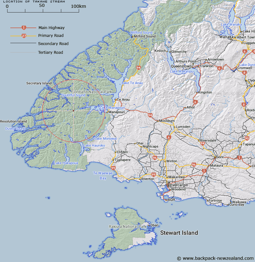
Map showing location of Takahe Stream


LINZ description: Near the Manapouri-Doubtful Sound track. Rises on north eastern slopes of Mattehorn Peak and flows generally easterly into Spey River.
Latitude: -45.544341
Longitude: 167.202561
Northing: 4940206.4
Easting: 1147434.9
Land District: Southland
Feat Type: Stream


Scroll down to see a more detailed road map and below that a topographical map showing the location of Takahe Stream. The road map has been supplied by openstreetmap and the topographical map of Takahe Stream has been supplied by Land Information New Zealand (LINZ).

Yes you can use the top static map for you school/university project or personal website with a link back. Contact me for any commercial use.

Takahe Stream Map New Zealand


New Zealand places in our database
[ A ] [ B ] [ C ] [ D ] [ E ] [ F ] [ G ] [ H ] [ I ] [ J ] [ K ] [ L ] [ M ] [ N ] [ O ] [ P ] [ Q ] [ R ] [ S ] [ T ] [ U ] [ V ] [ W ] [ X ] [ Y ] [ Z ]


Closest 20 Streams to Takahe Stream

Spey River ( 1.07km )   Dashwood Stream ( 1.52km )   Todd Burn ( 2.37km )   Waterfall Creek ( 3.4km )   Diamond Creek ( 3.71km )   Sholl Stream ( 3.96km )   Shott Stream ( 3.96km )   Cockburn Stream ( 3.98km )   Disaster Burn ( 4.79km )   Wynne Burn ( 4.84km )   Wynn Burn ( 4.84km )   Brae Burn ( 5.15km )   Percy Stream ( 5.5km )   Mica Burn ( 5.72km )   Warren Burn ( 6.04km )   Emerald Stream ( 6.64km )   Lyvia River ( 7.05km )   Stella Burn ( 7.17km )   Wolfe Burn ( 7.97km )   Seaforth River ( 8.63km )   Kintail Stream ( 9.69km )   Oonah Burn ( 10.65km )   Kenneth Burn ( 13.19km )   Bessie Burn ( 13.43km )   Florence Stream North Branch ( 14.69km )   Awe Burn ( 14.84km )   Elizabeth River ( 14.94km )   Deadwood Creek ( 15.01km )   Wekawai Stream ( 15.29km )   Florence Stream ( 17.94km )   Bishop Burn ( 18.25km )   Jane Burn ( 19.68km )   Anehu Stream ( 20.69km )   Wai-waiata Stream ( 20.86km )   Hauroko Burn ( 20.96km )   Gilmour Burn ( 21.43km )   Garnock Burn ( 21.73km )   Elaine Stream ( 21.99km )   Stevens Burn ( 22.17km )   Macfarlane Stream ( 22.3km )