Map showing location of Taheke Rock


LINZ description: A reef northeast of Nukutaunga Island, Northland.
Latitude: -34.9625
Longitude: 173.983333
Northing: 6130674.1
Easting: 1689773.2
Land District: North Auckland
Feat Type: Reef


Scroll down to see a more detailed road map and below that a topographical map showing the location of Taheke Rock. The road map has been supplied by openstreetmap and the topographical map of Taheke Rock has been supplied by Land Information New Zealand (LINZ).

Yes you can use the top static map for you school/university project or personal website with a link back. Contact me for any commercial use.
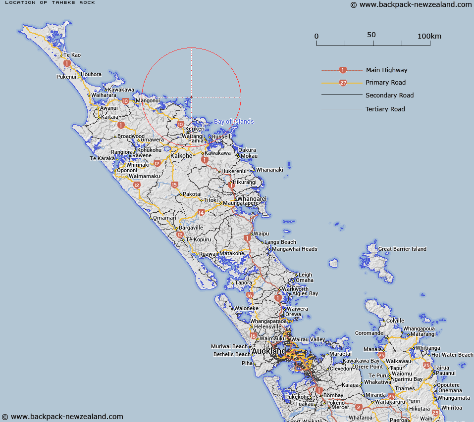
Taheke Rock Map New Zealand


New Zealand places in our database
[ A ] [ B ] [ C ] [ D ] [ E ] [ F ] [ G ] [ H ] [ I ] [ J ] [ K ] [ L ] [ M ] [ N ] [ O ] [ P ] [ Q ] [ R ] [ S ] [ T ] [ U ] [ V ] [ W ] [ X ] [ Y ] [ Z ]


Closest 20 Reefs to Taheke Rock

Tokananohia Reef (True Love Reef) ( 4.25km )   Waipunaiti Reef ( 8.86km )   Mapunanui Reef ( 8.94km )   Omorere Reef ( 12.68km )   Whakapoku Reef ( 16.71km )   Kawhiti Reef ( 20.72km )   Onslow Rock ( 27.79km )   Te Nunuhe Rock ( 32.06km )   Brampton Shoal ( 32.44km )   Capstan Rock ( 35.19km )   Oturori Rock ( 35.19km )   Hope Reef ( 36.78km )   Paramena Reef ( 37.23km )   Albert Reef ( 42.86km )   Nukutaurua Reef ( 42.86km )   Hongaio Rock ( 55.11km )   Orapa Rock ( 55.13km )   Staffa Rock ( 63.07km )   Gilbeys Rock ( 74.48km )   Elizabeth Reef ( 76.64km )   Dowd Rock ( 81.44km )   Northwest Reef ( 84.75km )   Nine Feet Rocks ( 84.75km )   Wellington Rock ( 97.23km )   Bream Rock ( 112.11km )   McGregor Rock ( 133.47km )   Miners Rock ( 172.56km )   Green Rock ( 177.38km )   Fairchild Reef ( 177.72km )   Passage Reef ( 182.83km )   Nelson Rock ( 183.15km )   Nelson Rock ( 183.21km )   Tarapunga Rock ( 184.29km )   Anchorite Rock ( 193.37km )   Wellington Rock ( 195.04km )   Bollons Rock ( 198.24km )   Arch Reef ( 198.31km )   Shearer Rock ( 201.03km )   Amodeo Rocks ( 201.3km )   T?kapu Rock ( 213.3km )