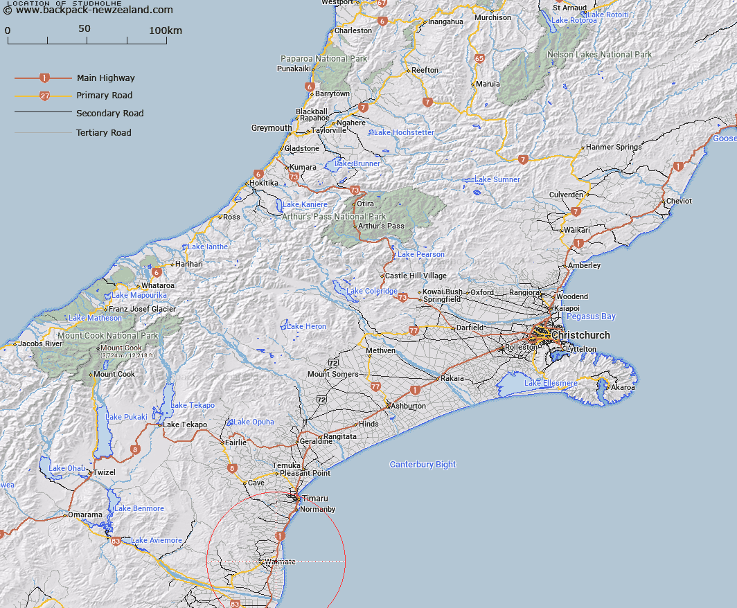
Map showing location of Studholme


LINZ description: Locality east of Waimate on Main South Road
Latitude: -44.727628
Longitude: 171.127241
Northing: 5045600
Easting: 1451700
Land District: Canterbury
Feat Type: Locality


Scroll down to see a more detailed road map and below that a topographical map showing the location of Studholme. The road map has been supplied by openstreetmap and the topographical map of Studholme has been supplied by Land Information New Zealand (LINZ).

Yes you can use the top static map for you school/university project or personal website with a link back. Contact me for any commercial use.

Studholme Map New Zealand


New Zealand places in our database
[ A ] [ B ] [ C ] [ D ] [ E ] [ F ] [ G ] [ H ] [ I ] [ J ] [ K ] [ L ] [ M ] [ N ] [ O ] [ P ] [ Q ] [ R ] [ S ] [ T ] [ U ] [ V ] [ W ] [ X ] [ Y ] [ Z ]


Closest 20 Localitys to Studholme

Nukuroa ( 1.72km )   Willowbridge ( 5.09km )   Hook ( 5.13km )   Maytown ( 6.12km )   Norton Reserve ( 6.19km )   Uretane ( 7.68km )   Te Waimate ( 7.82km )   Waituna ( 9.53km )   Morven ( 10.18km )   Makikihi ( 10.75km )   Green Hills ( 11.32km )   Gum Tree Flat ( 12.52km )   Arno ( 12.6km )   Broad Gully ( 12.7km )   Kapua ( 13.69km )   Hunter ( 14.14km )   Grays Corner ( 15.65km )   Dog Kennel ( 16.15km )   Waihao Forks ( 16.17km )   Otaio ( 16.91km )   Pikes Point ( 17.57km )   Waihao Downs ( 18.13km )   Waikakahi ( 18.25km )   Tawai ( 20.45km )   Kohika ( 20.68km )   Glenavy ( 20.85km )   Douglas ( 20.92km )   Saint Andrews ( 22.5km )   Esk Valley ( 22.64km )   Waitaki Bridge ( 23.5km )   Waihaorunga ( 24.41km )   Elephant Hill ( 24.92km )   Lyalldale ( 24.93km )   Springbrook ( 25.23km )   Redcliff ( 26.17km )   Ikawai ( 26.17km )   Pentland Hills ( 26.52km )   Bluecliffs ( 26.98km )   Blue Cliffs ( 26.98km )   Otaio Gorge ( 27.48km )