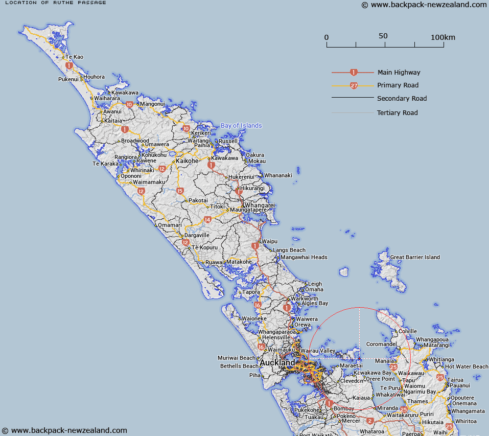
Map showing location of Ruthe Passage


LINZ description: Between Rotorua and Ponui Islands. Block VIII Waiheke Survey District.
Latitude: -36.826861
Longitude: 175.200543
Northing: 5922074.6
Easting: 1796252.4
Land District: North Auckland
Feat Type: Channel


Scroll down to see a more detailed road map and below that a topographical map showing the location of Ruthe Passage. The road map has been supplied by openstreetmap and the topographical map of Ruthe Passage has been supplied by Land Information New Zealand (LINZ).

Yes you can use the top static map for you school/university project or personal website with a link back. Contact me for any commercial use.
Ruthe Passage Map New Zealand


New Zealand places in our database
[ A ] [ B ] [ C ] [ D ] [ E ] [ F ] [ G ] [ H ] [ I ] [ J ] [ K ] [ L ] [ M ] [ N ] [ O ] [ P ] [ Q ] [ R ] [ S ] [ T ] [ U ] [ V ] [ W ] [ X ] [ Y ] [ Z ]


Closest 20 Channels to Ruthe Passage

Waiheke Channel ( 3.46km )   Sandspit Passage ( 8.47km )   Tamaki Strait ( 19.71km )   Waimate Channel ( 20.81km )   Sergeant Channel ( 20.96km )   Hautapu Channel ( 22.74km )   Little Passage ( 23.63km )   Motuihe Channel ( 24.5km )   Rakino Channel ( 25.77km )   Motukorea Channel ( 28.08km )   Rangitoto Channel ( 34.16km )   Whangaparaoa Passage ( 38.47km )   Papakura Channel ( 40.23km )   Little Hole in the Wall ( 49.12km )   Colville Channel ( 52.65km )   Blanche Channel ( 53km )   Waiuku Channel ( 53.03km )   South Channel ( 53.14km )   Purakau Channel ( 53.32km )   Rosario Channel ( 53.92km )   Wairopa Channel ( 54.11km )   Inner Channel ( 54.32km )   Wigmore Pass ( 54.86km )   Hole in the Wall ( 58.71km )   North Channel ( 58.75km )   The Needles ( 60.82km )   Manukau Entrance ( 64.03km )   Cradock Channel ( 67.76km )   The Gap ( 67.81km )   Man of War Passage (Governor Pass) ( 72.21km )   Jellicoe Channel ( 79.25km )   Tauhoa Channel ( 95.04km )   Tuapiro Channel ( 98.33km )   Blakneys Channel ( 99.47km )   Katikati Entrance ( 100.52km )   Otamatea Channel ( 102.09km )   Edith Passage ( 102.57km )   Kaipara Entrance ( 103.02km )   The Funnel ( 103.61km )   Narrows ( 110.01km )