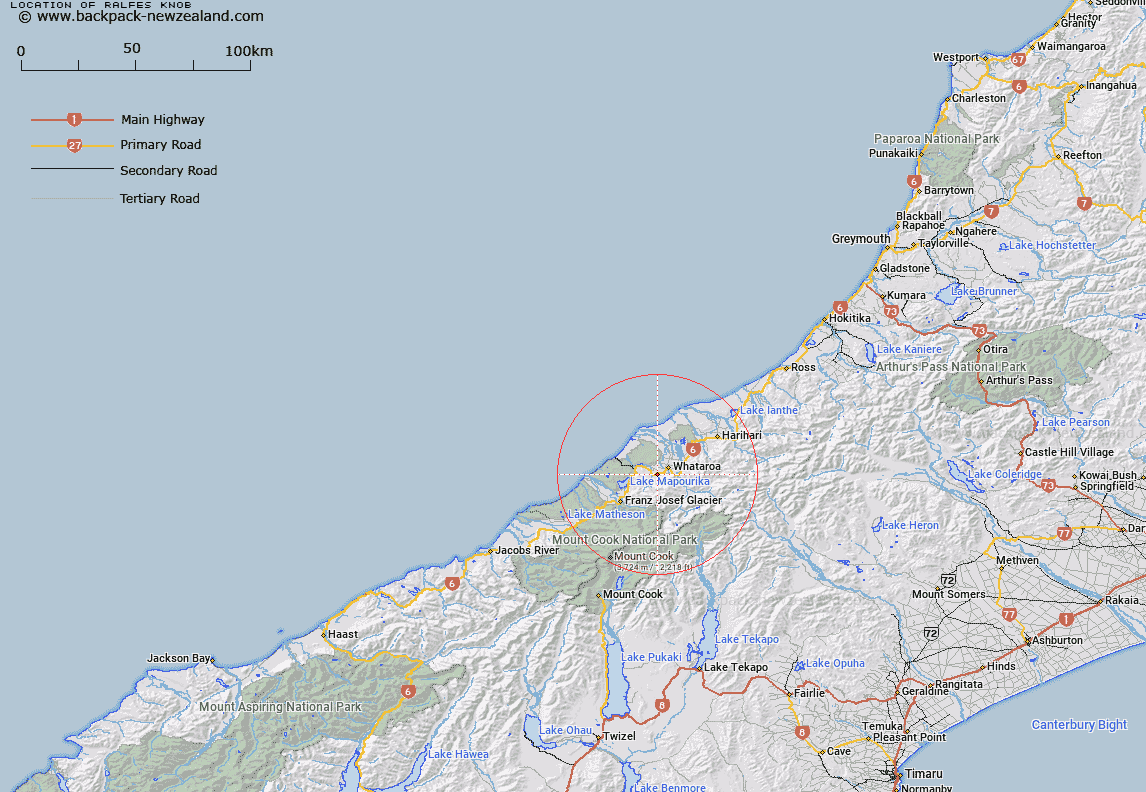
Map showing location of Ralfes Knob


LINZ description: Feature shown on: NZMS260 I35 Edition 1 1993 Limited Revision 1996
Latitude: -43.288833
Longitude: 170.322694
Northing: 5203629
Easting: 1382797.3
Land District: Westland
Feat Type: Hill


Scroll down to see a more detailed road map and below that a topographical map showing the location of Ralfes Knob. The road map has been supplied by openstreetmap and the topographical map of Ralfes Knob has been supplied by Land Information New Zealand (LINZ).

Yes you can use the top static map for you school/university project or personal website with a link back. Contact me for any commercial use.
Ralfes Knob Map New Zealand


New Zealand places in our database
[ A ] [ B ] [ C ] [ D ] [ E ] [ F ] [ G ] [ H ] [ I ] [ J ] [ K ] [ L ] [ M ] [ N ] [ O ] [ P ] [ Q ] [ R ] [ S ] [ T ] [ U ] [ V ] [ W ] [ X ] [ Y ] [ Z ]


Closest 20 Hills to Ralfes Knob

Mount Price ( 3.31km )   Fardowner Peak ( 6.11km )   Gunn Peak ( 6.83km )   Mount Bird ( 7.03km )   Mount Cloher ( 9.27km )   Mount Downe ( 11.5km )   McFetrick Peak ( 11.87km )   The Exile ( 14.08km )   Junction Peak ( 14.09km )   Mount Spencer ( 14.88km )   Mount Burster ( 15.97km )   Mount Mueller ( 16.09km )   Neophyte Peak ( 16.36km )   Canavans Knob ( 16.44km )   Kohuamarua ( 16.45km )   Mount Adams ( 16.72km )   Park Peak ( 16.82km )   Mount Park ( 16.83km )   Sugar Loaf ( 17.07km )   Wilczek Peak ( 17.1km )   Bamford Knob ( 17.22km )   King Peak ( 17.64km )   Mount Hercules ( 17.75km )   Mount Alec ( 17.98km )   Tohunga Peak ( 18.4km )   Mount Whataroa ( 18.74km )   Mount Peter ( 18.89km )   Annie Peak ( 19.13km )   Sentinel Rock ( 19.56km )   Mount Gunn ( 19.63km )   Roderick Peak ( 19.75km )   Mount Rangatira ( 19.8km )   Mount Barrowman ( 19.99km )   Goatpath ( 20.32km )   Mount Loughnan ( 20.34km )   Thelma Peak ( 20.55km )   Louisa Peak ( 20.58km )   Artemis Peak ( 20.66km )   Dog Kennel Peak ( 20.74km )   Alex Knob ( 20.76km )