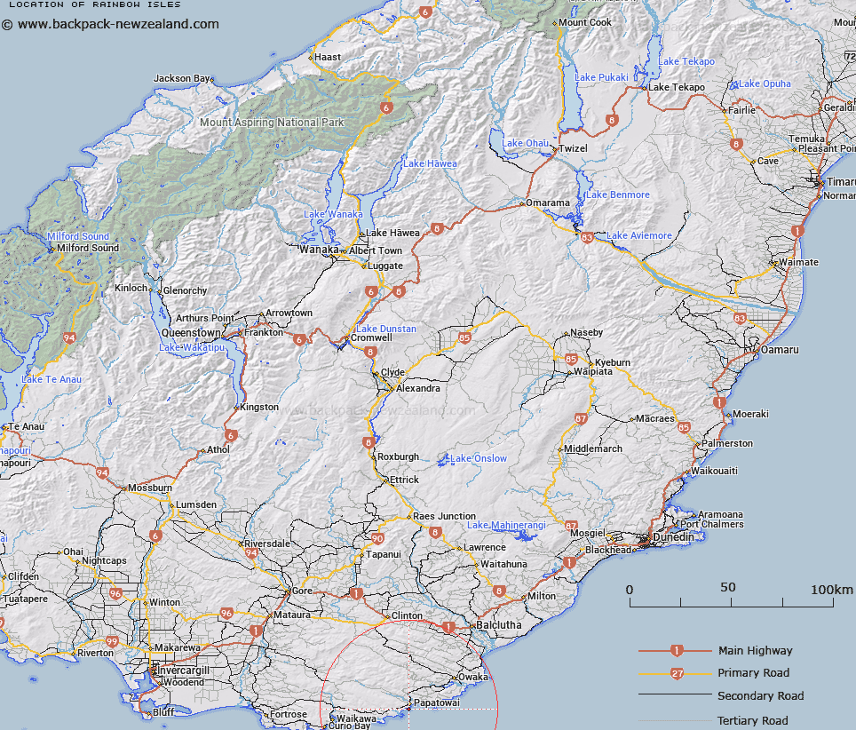
Map showing location of Rainbow Isles


LINZ description: Feature shown on: NZMS260 G47
Latitude: -46.583111
Longitude: 169.465278
Northing: 4835090.2
Easting: 1329197
Land District: Otago
Feat Type: Island


Scroll down to see a more detailed road map and below that a topographical map showing the location of Rainbow Isles. The road map has been supplied by openstreetmap and the topographical map of Rainbow Isles has been supplied by Land Information New Zealand (LINZ).

Yes you can use the top static map for you school/university project or personal website with a link back. Contact me for any commercial use.
Rainbow Isles Map New Zealand


New Zealand places in our database
[ A ] [ B ] [ C ] [ D ] [ E ] [ F ] [ G ] [ H ] [ I ] [ J ] [ K ] [ L ] [ M ] [ N ] [ O ] [ P ] [ Q ] [ R ] [ S ] [ T ] [ U ] [ V ] [ W ] [ X ] [ Y ] [ Z ]


Closest 20 Islands to Rainbow Isles

Frances Pillars ( 4.79km )   Kinakina Island ( 8.32km )   Chasm Island ( 10.11km )   Cosgrove Island ( 11.8km )   The Sisters ( 16.89km )   Duff Islands ( 18.04km )   White Islands ( 19.21km )   Tuhawhaiki Island ( 21km )   Tuhawaiki Island ( 21km )   Tuawaiki Island ( 21km )   Triplets ( 23.73km )   Shaws Island ( 40.07km )   Inch Clutha ( 41.1km )   Manuka Island ( 46.52km )   Waitahuna Island ( 48.75km )   Gull Island ( 51.04km )   Seal Rocks ( 68.85km )   Green Island ( 71.02km )   Lee Island ( 71.96km )   Birch Island ( 75.07km )   Ruapuke Island ( 75.52km )   Island Rock ( 76.71km )   South Islets ( 77.16km )   White Island ( 77.87km )   Topi Island ( 78.99km )   Dog Island ( 80.94km )   Hazelburgh Group ( 81.1km )   Bird Island ( 82.06km )   Ram Island ( 82.1km )   Joeys Island ( 82.1km )   Taieri Island ( 82.13km )   Taieri Island/Moturata ( 82.13km )   Half Passage Rock ( 85.16km )   Fife Rock ( 85.52km )   Island Harbour ( 86.52km )   Rabbit Island ( 86.79km )   Seal Rock ( 86.91km )   Tikore Island ( 87.65km )   Colyers Island ( 88.1km )   Shag Rock ( 91.21km )