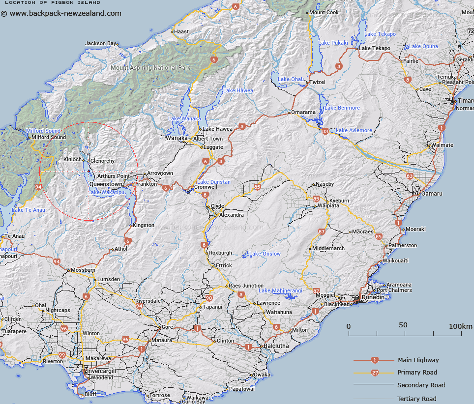
Map showing location of Pigeon Island


LINZ description: Feature shown on: NZMS260-E41 465770; NZTopo50-CB10 364152;
Latitude: -44.92362
Longitude: 168.392816
Northing: 5015200
Easting: 1236400
Land District: Otago
Feat Type: Island


Scroll down to see a more detailed road map and below that a topographical map showing the location of Pigeon Island. The road map has been supplied by openstreetmap and the topographical map of Pigeon Island has been supplied by Land Information New Zealand (LINZ).

Yes you can use the top static map for you school/university project or personal website with a link back. Contact me for any commercial use.

Pigeon Island Map New Zealand


New Zealand places in our database
[ A ] [ B ] [ C ] [ D ] [ E ] [ F ] [ G ] [ H ] [ I ] [ J ] [ K ] [ L ] [ M ] [ N ] [ O ] [ P ] [ Q ] [ R ] [ S ] [ T ] [ U ] [ V ] [ W ] [ X ] [ Y ] [ Z ]


Closest 20 Islands to Pigeon Island

Tree Island ( 2.34km )   Pig Island/M?tau ( 2.62km )   Pig Island ( 2.62km )   Hogget Island ( 15.48km )   Hidden Island ( 25.92km )   Lion Island ( 42.72km )   Lee Island ( 42.82km )   Lone Island ( 47.98km )   Dot Island ( 48.5km )   Entrance Island ( 51.01km )   The Island ( 57.93km )   Centre Island ( 59.67km )   Ruby Island ( 62.2km )   Doubtful Island ( 62.83km )   Crescent Island ( 63.38km )   Mou Tapu ( 63.38km )   Erin Island ( 63.89km )   Bute Island ( 64km )   Brig Rock ( 65.26km )   Cumbrae Island ( 65.73km )   Bull Island ( 65.78km )   Arran Island ( 65.89km )   Mou Waho ( 68.25km )   Harwich Island ( 68.25km )   Pigeon Island ( 68.25km )   Stevensons Island ( 69.04km )   Dome Islands ( 72.74km )   Mervyn Island ( 72.88km )   Baybles Island ( 73.03km )   Gorge Islands ( 84.24km )   Browne Island ( 87.67km )   Houseroof Rock ( 89.53km )   Buncrana Island ( 90.18km )   Inch Keith ( 90.47km )   Rona Island ( 91.82km )   Silver Island ( 92.26km )   Barn Islands ( 94km )   The Sugar Loaf ( 94.43km )   Isolde Island ( 94.59km )   Belle Vue Island ( 94.82km )