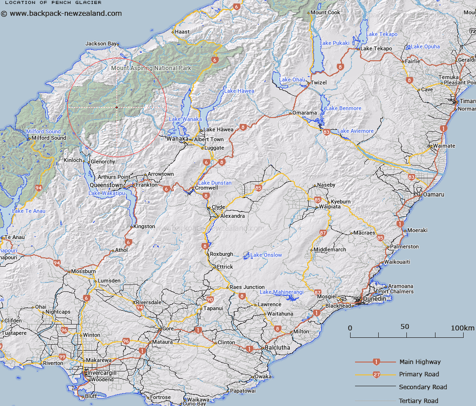
Map showing location of Pench Glacier


LINZ description: Below and south-west of Mount Māori
Latitude: -44.439565
Longitude: 168.604502
Northing: 5069900
Easting: 1250200
Land District: Otago
Feat Type: Glacier


Scroll down to see a more detailed road map and below that a topographical map showing the location of Pench Glacier. The road map has been supplied by openstreetmap and the topographical map of Pench Glacier has been supplied by Land Information New Zealand (LINZ).

Yes you can use the top static map for you school/university project or personal website with a link back. Contact me for any commercial use.

Pench Glacier Map New Zealand


New Zealand places in our database
[ A ] [ B ] [ C ] [ D ] [ E ] [ F ] [ G ] [ H ] [ I ] [ J ] [ K ] [ L ] [ M ] [ N ] [ O ] [ P ] [ Q ] [ R ] [ S ] [ T ] [ U ] [ V ] [ W ] [ X ] [ Y ] [ Z ]


Closest 20 Glaciers to Pench Glacier

Dart Glacier ( 1.05km )   Park Glacier ( 1.23km )   Liverpool Glacier ( 1.49km )   Snow White Glacier ( 2.27km )   Christopher Johnson Glacier ( 2.58km )   Reid Glacier ( 2.87km )   Marshall Glacier ( 4.06km )   Whitbourn Glacier ( 4.84km )   Hesse Glacier ( 4.93km )   Arawata Glacier ( 5.5km )   Arawhata Glacier ( 5.5km )   Hobbs Glacier ( 5.79km )   Geikie Glacier ( 6.27km )   Mercer Glacier ( 6.38km )   Davis Glacier ( 6.68km )   Bruckner Glacier ( 7.31km )   Ferrier Glacier ( 8.61km )   Breakaway ( 8.65km )   Snowball Glaciers ( 8.75km )   Key Dome ( 9.23km )   Bonar Glacier ( 9.54km )   Isobel Glacier ( 9.54km )   Maud Francis Glacier ( 10.12km )   Blue Duck Glacier ( 10.12km )   Flight Deck ( 10.72km )   Iso Glacier ( 10.77km )   Tyndall Glacier ( 10.88km )   Hamilton Glacier ( 10.93km )   Hood Glacier ( 11.57km )   Victoria Glacier ( 11.66km )   Rob Roy Glacier ( 11.71km )   Therma Glacier ( 11.72km )   Avalanche Glacier ( 11.72km )   Curzon Glacier ( 12.34km )   Dipso Glacier ( 12.38km )   Suet Glacier ( 13.36km )   Kitchener Glacier ( 13.7km )   Lower Volta Glacier ( 14.35km )   Whitehead Glacier ( 14.37km )   John Inglis Glacier ( 15.02km )