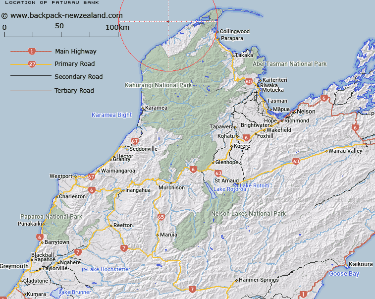
Map showing location of Paturau Bank


LINZ description: Nelson Shelf, northern South Island An area of irregular topography on the inner continental shelf off northwest Nelson, between 10 km and 15 km from shore. Rises from 80 m to 40 m depth. NZTopo50-BN23 GR 408 054
Latitude: -40.6
Longitude: 172.3
Northing: 5505409.7
Easting: 1540774.2
Land District: Nelson
Feat Type: Bank


Scroll down to see a more detailed road map and below that a topographical map showing the location of Paturau Bank. The road map has been supplied by openstreetmap and the topographical map of Paturau Bank has been supplied by Land Information New Zealand (LINZ).

Yes you can use the top static map for you school/university project or personal website with a link back. Contact me for any commercial use.

Paturau Bank Map New Zealand


New Zealand places in our database
[ A ] [ B ] [ C ] [ D ] [ E ] [ F ] [ G ] [ H ] [ I ] [ J ] [ K ] [ L ] [ M ] [ N ] [ O ] [ P ] [ Q ] [ R ] [ S ] [ T ] [ U ] [ V ] [ W ] [ X ] [ Y ] [ Z ]


Closest 20 Banks to Paturau Bank

The Shellbanks ( 62.13km )   Middle Bank ( 133.77km )   Graham Bank ( 196.89km )   Patea Banks ( 197.63km )   North Trap ( 205.92km )   South Trap ( 207.3km )   Hunter Bank ( 215.77km )   Nicholson Bank ( 228.51km )   Palliser Bank ( 275.6km )   Kaukau Bank ( 288.39km )   Opouawe Bank ( 290.97km )   Pahaua Bank ( 301.32km )   Adams Bank ( 323.02km )   Kaiwhata Bank ( 327.88km )   Whareama Bank ( 339.04km )   Otutere Bank ( 374.56km )   Raglan Bar ( 379.92km )   South Bank ( 434.82km )   North Bank ( 437.07km )   Poutawa Bank ( 443.18km )   Huia Bank ( 444.07km )   Hangore Bank ( 444.78km )   Karore Bank ( 448.22km )   Hikihiki Bank ( 449.72km )   Te Tau Bank ( 451.13km )   Motukaraka Bank ( 455.97km )   Centre Bank ( 468.06km )   Matakana Bank ( 469.83km )   Duder Spit ( 476.75km )   Omokoiti Flats ( 487.86km )   Kaipara Flats ( 492.75km )   Kakaraia Flats ( 496.84km )   Tapora Bank ( 498.1km )   Lady Franklin Bank ( 500.36km )   Middle Bank ( 506.72km )   Kuri Banks ( 530.72km )   Te Arawa High ( 551.32km )   Ariel Bank ( 557.74km )   Mair Bank ( 562.77km )   Calliope Bank ( 564.11km )