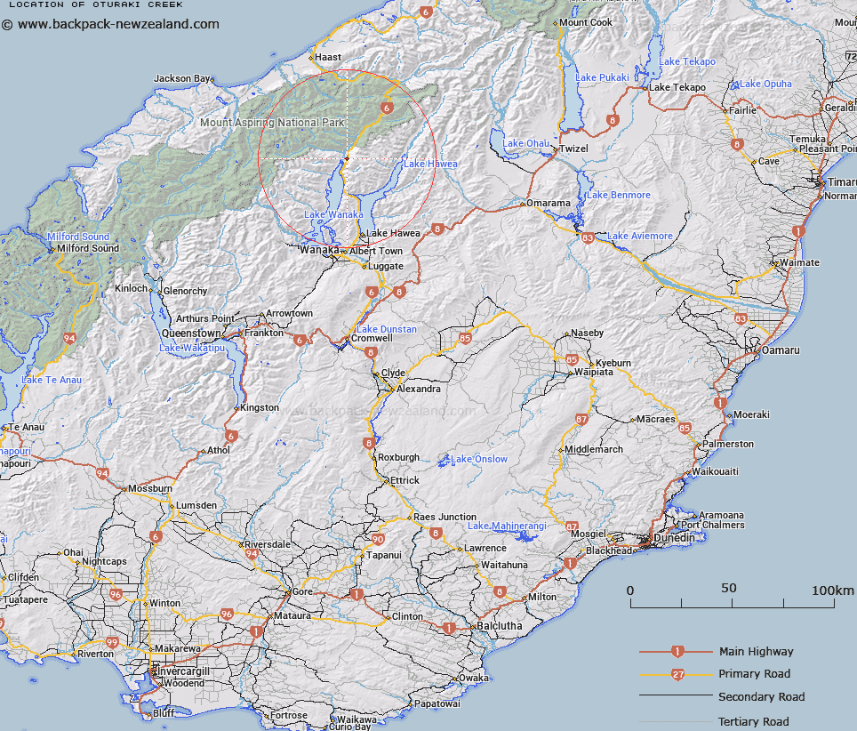
Map showing location of Ōturaki Creek


LINZ description: Flowing westerly from approximately 2km west of Mount White into the northern shores of Lake Wanaka. NZTopo50 BZ12-Makarora, source: GR 982 872 to confluence: GR 951 872.
Latitude: -44.298178
Longitude: 169.196971
Northing: 5087971.4
Easting: 1296621
Land District: Otago
Feat Type: Stream


Scroll down to see a more detailed road map and below that a topographical map showing the location of Ōturaki Creek. The road map has been supplied by openstreetmap and the topographical map of Ōturaki Creek has been supplied by Land Information New Zealand (LINZ).

Yes you can use the top static map for you school/university project or personal website with a link back. Contact me for any commercial use.

Ōturaki Creek Map New Zealand


New Zealand places in our database
[ A ] [ B ] [ C ] [ D ] [ E ] [ F ] [ G ] [ H ] [ I ] [ J ] [ K ] [ L ] [ M ] [ N ] [ O ] [ P ] [ Q ] [ R ] [ S ] [ T ] [ U ] [ V ] [ W ] [ X ] [ Y ] [ Z ]


Closest 20 Streams to Ōturaki Creek

Flaxmill Creek ( 0.2km )   Cemetery Creek ( 1.66km )   Wharf Creek ( 2.5km )   Waterfall Creek ( 2.5km )   Boggy Creek ( 2.52km )   Ewings Creek ( 4.35km )   Boundary Creek ( 5.71km )   Station Creek ( 6.32km )   Tiel Creek ( 7.19km )   Teal Creek ( 7.19km )   White Creek ( 7.34km )   Craigie Burn ( 8.22km )   Pipson Creek ( 8.37km )   Sheepskin Creek ( 8.68km )   Waterfall Creek ( 8.68km )   Camp Creek ( 10.2km )   Sawmill Creek ( 10.55km )   Rambling Burn ( 10.91km )   Young River ( 11.18km )   Big Hopwood Burn ( 11.83km )   Brady Creek ( 12.38km )   Terrace Creek ( 12.78km )   High Burn ( 12.87km )   Fast Burn ( 13.02km )   Bay Burn ( 13.09km )   Little Hopwood Burn ( 13.38km )   Terrace Creek South Branch ( 13.51km )   Makarora River ( 13.57km )   Templeton Creek ( 13.97km )   Leven Stream ( 13.99km )   Young River South Branch ( 14.38km )   Sawyer Burn ( 14.52km )   The Neck Creek ( 14.6km )   Camerons Creek ( 14.7km )   Albert Burn ( 14.74km )   Ore Stream ( 15.33km )   Rough Burn ( 15.61km )   Kidds Creek ( 15.71km )   McGregor Creek ( 15.74km )   Bee Burn ( 15.78km )