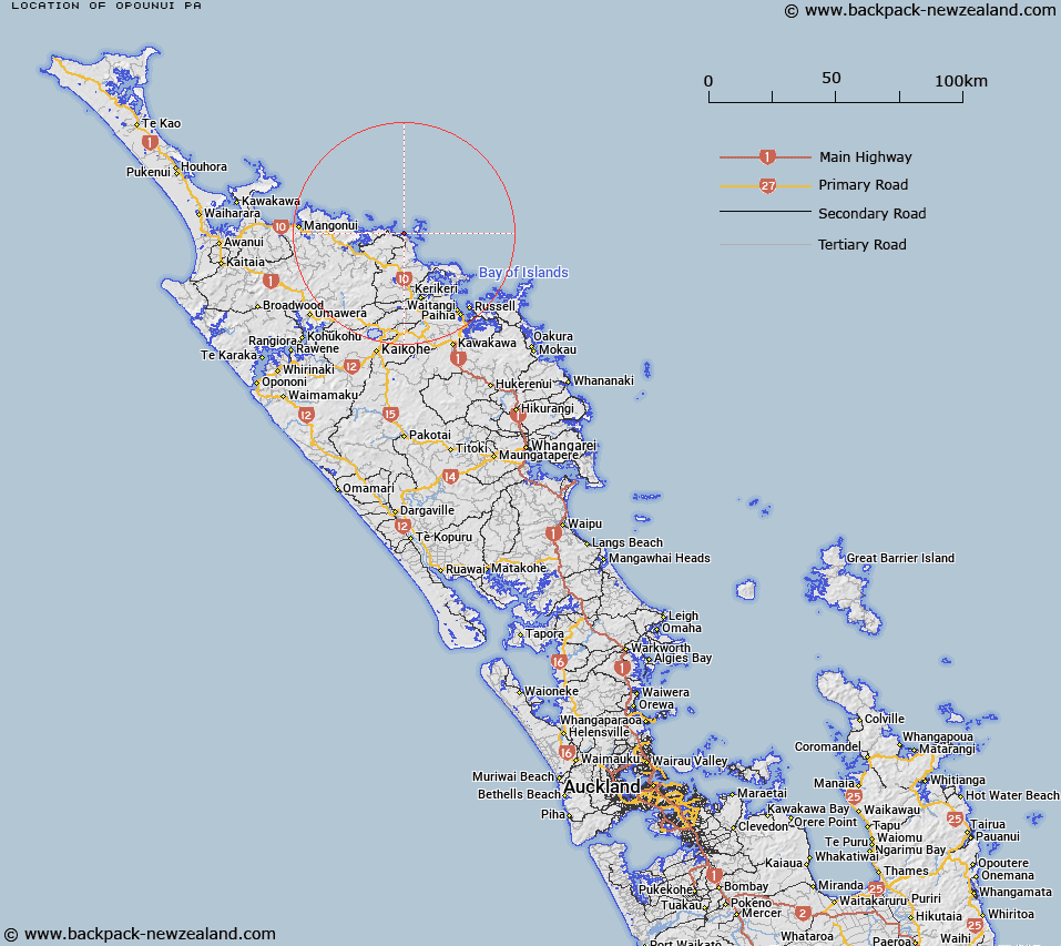
Map showing location of Opounui Pa


LINZ description: Māori Pa site near Opounui Point, 3.2km North of Matauri Bay locality. Whakarara Survey District.
Latitude: -35.013205
Longitude: 173.89838
Northing: 6125123.8
Easting: 1681966.7
Land District: North Auckland
Feat Type: Site


Scroll down to see a more detailed road map and below that a topographical map showing the location of Opounui Pa. The road map has been supplied by openstreetmap and the topographical map of Opounui Pa has been supplied by Land Information New Zealand (LINZ).

Yes you can use the top static map for you school/university project or personal website with a link back. Contact me for any commercial use.

Opounui Pa Map New Zealand


New Zealand places in our database
[ A ] [ B ] [ C ] [ D ] [ E ] [ F ] [ G ] [ H ] [ I ] [ J ] [ K ] [ L ] [ M ] [ N ] [ O ] [ P ] [ Q ] [ R ] [ S ] [ T ] [ U ] [ V ] [ W ] [ X ] [ Y ] [ Z ]


Closest 20 Sites to Opounui Pa

Opepe Pa ( 0.5km )   Opipi Pa ( 0.55km )   Rawitiroa Pa ( 3.51km )   Kauwaiorangi Pa ( 4.91km )   Haimama Pa ( 9.28km )   Orongo Pa ( 10.03km )   Rangihamama Pa ( 10.65km )   Paoeone Pa ( 14.87km )   Okiore Pa ( 17.33km )   Whitinui Pa ( 17.62km )   Whitiora Pa ( 17.73km )   Pukewhau Pa ( 23.56km )   Tikorangi Pa ( 23.93km )   Te Aroha Marae ( 24.73km )   Rangihoua Pa ( 24.76km )   Hohi ( 24.87km )   Pukewhau Pa ( 28.64km )   Whakataha Pa ( 30.83km )   Puketona Pa ( 31.81km )   Tapeka Pa ( 32.56km )   Waitangi Marae ( 33.5km )   Okuratope Pa ( 34.44km )   Hikurangi Pa ( 34.87km )   Ngaungau Pa ( 34.94km )   Haikai Pa ( 35.03km )   Pahangahanga Pa ( 35.29km )   Captain Cook's Anchorage ( 35.51km )   Te Homamu Pa ( 36.03km )   Paeroa Pa ( 36.21km )   Te Ahuahu Marae ( 36.25km )   Otanenui Pa ( 36.63km )   Takaporuruku Pa ( 36.7km )   Tapahuarau Pa ( 36.75km )   Nga Pukepango Pa ( 36.98km )   Mawe Pa ( 37.25km )   Te Rua Haonga Pa ( 37.35km )   Kahuwhera Pa ( 37.71km )   Haruru Pa ( 38.16km )   Paroa Pa ( 38.31km )   Taurikura Pa ( 38.63km )