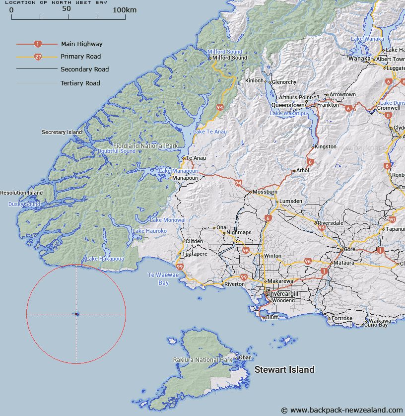
Map showing location of North-west Bay


LINZ description: Bay on north-west side Solander Island. Feature shown on: NZMS260 B46 B47; NZTopo50-CH05/CH06 318242
Latitude: -46.57203
Longitude: 166.889363
Northing: 4824226.7
Easting: 1131787.8
Land District: Southland
Feat Type: Bay


Scroll down to see a more detailed road map and below that a topographical map showing the location of North-west Bay. The road map has been supplied by openstreetmap and the topographical map of North-west Bay has been supplied by Land Information New Zealand (LINZ).

Yes you can use the top static map for you school/university project or personal website with a link back. Contact me for any commercial use.

North-west Bay Map New Zealand


New Zealand places in our database
[ A ] [ B ] [ C ] [ D ] [ E ] [ F ] [ G ] [ H ] [ I ] [ J ] [ K ] [ L ] [ M ] [ N ] [ O ] [ P ] [ Q ] [ R ] [ S ] [ T ] [ U ] [ V ] [ W ] [ X ] [ Y ] [ Z ]


Closest 20 Bays to North-west Bay

South-west Bay ( 0.82km )   Eastern Bay ( 1.16km )   Prices Harbour ( 38.14km )   Knife and Steel Harbour ( 38.95km )   Gates Harbour ( 43.89km )   Kisbee Bay ( 53.4km )   Fishing Bay ( 55.36km )   Revolver Bay ( 56.31km )   Preservation Inlet ( 57.08km )   Harries Bay ( 59.16km )   Cuttle Cove ( 59.16km )   North West Bay ( 59.36km )   Big Bight ( 59.47km )   Welcombe Bay ( 59.52km )   Useless Bay ( 59.52km )   Brokenshore Bay ( 60.01km )   Seek Cove ( 60.4km )   Te Waewae Bay ( 61.07km )   Isthmus Sound ( 61.32km )   Lee Bay ( 61.77km )   Sealers Bay ( 61.81km )   Jane Coves ( 62.41km )   South Port ( 62.52km )   Roderiques Anchorage ( 63.02km )   Lady Bay ( 63.12km )   South Bay ( 63.14km )   Anchorage Cove ( 63.52km )   Teal Bay ( 64.14km )   Boat Cove ( 64.56km )   Sealers Bay ( 65.22km )   Long Sound ( 65.77km )   Halt Bay ( 66.03km )   Last Cove ( 66.33km )   Chalky Inlet ( 66.49km )   Waituna Bay ( 67.53km )   Cosy Nook ( 68.31km )   Cliff Cove ( 68.43km )   Cunaris Sound ( 69.54km )   Long Harry Bay ( 70.08km )   Watering Cove ( 70.08km )