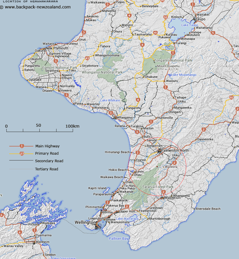
Map showing location of Ngawhakarara
LINZ description: A hill at height 855m located in the Tararua Range approximately 22km south of Palmerston North. Feature shown on NZMS260 S25 Pt R25 Edition 2 1995; NZTopo50-BN34 185076.
Latitude: -40.553406
Longitude: 175.58112
Northing: 5507615.5
Easting: 1818546.3
Land District: Wellington
Feat Type: Hill
Latitude: -40.553406
Longitude: 175.58112
Northing: 5507615.5
Easting: 1818546.3
Land District: Wellington
Feat Type: Hill

Scroll down to see a more detailed road map and below that a topographical map showing the location of Ngawhakarara. The road map has been supplied by openstreetmap and the topographical map of Ngawhakarara has been supplied by Land Information New Zealand (LINZ).
Yes you can use the top static map for you school/university project or personal website with a link back. Contact me for any commercial use.
[ A ] [ B ] [ C ] [ D ] [ E ] [ F ] [ G ] [ H ] [ I ] [ J ] [ K ] [ L ] [ M ] [ N ] [ O ] [ P ] [ Q ] [ R ] [ S ] [ T ] [ U ] [ V ] [ W ] [ X ] [ Y ] [ Z ]