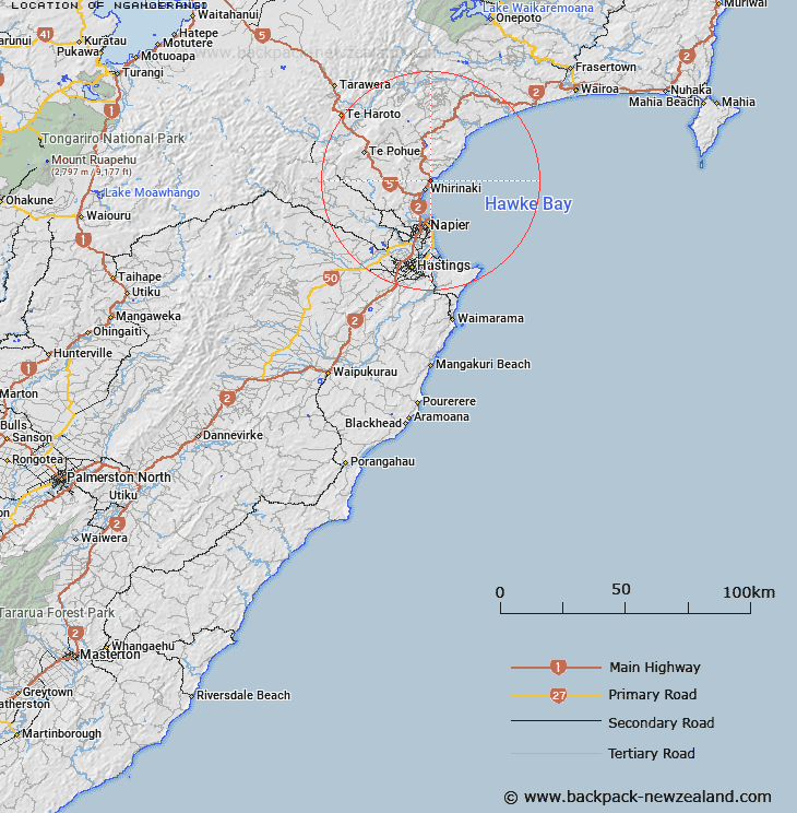
Map showing location of Ngāmoerangi


LINZ description: An historic site southwest of the mouth of Pākuratahi Stream and Te Ngarue Stream. NZTopo50-BJ39 371371 to 373373.
Latitude: -39.34888
Longitude: 176.912825
Northing: 5637200
Easting: 1937200
Land District: Hawke's Bay
Feat Type: Site


Scroll down to see a more detailed road map and below that a topographical map showing the location of Ngāmoerangi. The road map has been supplied by openstreetmap and the topographical map of Ngāmoerangi has been supplied by Land Information New Zealand (LINZ).

Yes you can use the top static map for you school/university project or personal website with a link back. Contact me for any commercial use.

Ngāmoerangi Map New Zealand


New Zealand places in our database
[ A ] [ B ] [ C ] [ D ] [ E ] [ F ] [ G ] [ H ] [ I ] [ J ] [ K ] [ L ] [ M ] [ N ] [ O ] [ P ] [ Q ] [ R ] [ S ] [ T ] [ U ] [ V ] [ W ] [ X ] [ Y ] [ Z ]


Closest 20 Sites to Ngāmoerangi

Panepaoa ( 0.29km )   Te Rae-o-Tangoio ( 1.22km )   Te Areare ( 2.03km )   Rangi?taahua ( 2.77km )   Tiwhanui ( 18.85km )   Pukekura Pa ( 20.43km )   Puketapu Pa ( 21.53km )   Kopuaroa Pa ( 22.65km )   Motu-o-R?r? ( 22.8km )   Otatara Pa ( 23.45km )   Colenso Memorial ( 23.58km )   Waitangi Mission Station 1844-1852 ( 24.12km )   Tauwhare Papauma ( 24.8km )   Ohikakawera Pa ( 25.21km )   Te Hora Pa ( 28.75km )   Matahiwi Marae ( 28.91km )   Runanga Pa ( 29.84km )   Ruahapia Marae ( 30.34km )   Ohiti Pa ( 35.12km )   Bridge Pa ( 35.95km )   Korongata Marae ( 36.2km )   Mangaroa Hauora Marae ( 36.52km )   Tupurupuru Pa ( 38.46km )   Takitimu Marae ( 55.39km )   Kihitu Pa ( 55.48km )   Rangiahua Marae ( 56.98km )   Iwitea Pa ( 61.93km )   Waimako Pa ( 62.29km )   Pukehuia Pa ( 67.92km )   Whakaari Pa ( 68.51km )   Mokau Pa ( 69.76km )   Waipukurau Marae ( 78.24km )   Colenso Memorial ( 85.59km )   Te Hoe Whaling Station ( 85.67km )   Harema ( 85.86km )   Umurakau ( 87.25km )   Opepe Monument ( 88.02km )   Mahangaiti Pa ( 88.46km )   Matuku Ridge Pa ( 90.29km )   Kopuawhara Disaster 1938 ( 92.29km )