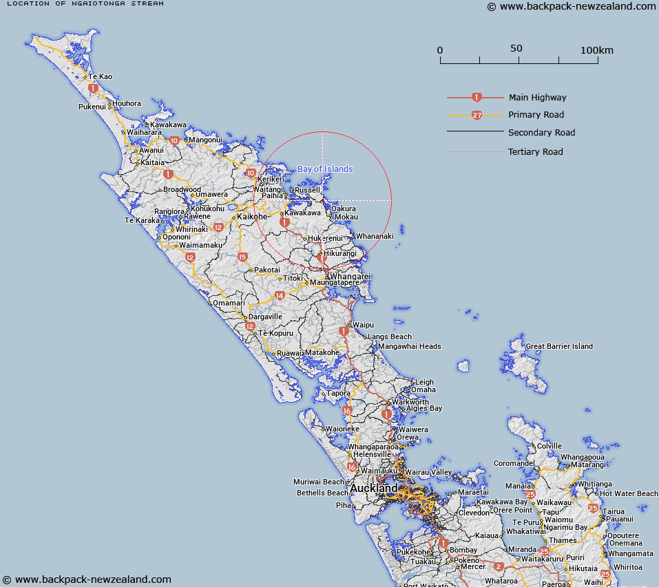
Map showing location of Ngaiotonga Stream


LINZ description: Feature shown on: NZMS260 Q05 Edition 1 1983
Latitude: -35.312778
Longitude: 174.296972
Northing: 6091498.7
Easting: 1717902.1
Land District: North Auckland
Feat Type: Stream


Scroll down to see a more detailed road map and below that a topographical map showing the location of Ngaiotonga Stream. The road map has been supplied by openstreetmap and the topographical map of Ngaiotonga Stream has been supplied by Land Information New Zealand (LINZ).

Yes you can use the top static map for you school/university project or personal website with a link back. Contact me for any commercial use.
Ngaiotonga Stream Map New Zealand


New Zealand places in our database
[ A ] [ B ] [ C ] [ D ] [ E ] [ F ] [ G ] [ H ] [ I ] [ J ] [ K ] [ L ] [ M ] [ N ] [ O ] [ P ] [ Q ] [ R ] [ S ] [ T ] [ U ] [ V ] [ W ] [ X ] [ Y ] [ Z ]


Closest 20 Streams to Ngaiotonga Stream

Whakapai Stream ( 1.28km )   Tutaematai Stream ( 1.79km )   Waitao Stream ( 2.2km )   Whakapae Stream ( 2.55km )   Racehorse River ( 2.56km )   Waiata Stream ( 2.57km )   Haranui Stream ( 2.62km )   Kareawhau Stream ( 2.75km )   Pakehaua Stream ( 2.86km )   Waimangarua Stream ( 2.98km )   Matakohia Stream ( 3.16km )   Taratanui Stream ( 3.97km )   Waikokopu Stream ( 4.8km )   Parangiora Stream ( 5.21km )   Papakauri Stream ( 5.45km )   Wairoa Stream ( 5.69km )   Mangakura Stream ( 5.92km )   Mangamaeho Stream ( 5.92km )   Puhinui Stream ( 6.27km )   Pukenui Stream ( 6.28km )   Whakawhiti Stream ( 6.54km )   Mungatupara Stream ( 6.82km )   Tangatapu Stream ( 7.07km )   Waikare River ( 7.76km )   Owharo Stream ( 7.77km )   Manawaora Creek ( 8.33km )   Man-o-war Creek ( 8.33km )   Whiorau Stream ( 8.43km )   Man o War Creek ( 8.59km )   Te Ngako Creek ( 9.28km )   Wheronui Stream ( 9.29km )   Waihaha Stream ( 9.57km )   Kaipo Creek ( 9.87km )   Oakura Stream ( 9.91km )   Kanaerene Creek ( 10.23km )   Puakainga Creek ( 10.44km )   Whakatane Stream ( 10.97km )   Punaruku Stream ( 11.54km )   Karetu Stream ( 11.76km )   Ngangeroa Creek ( 12.06km )