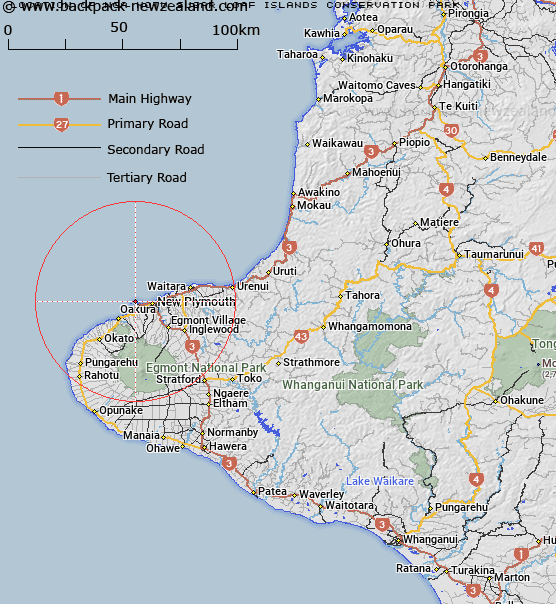
Map showing location of Ngā Motu / Sugar Loaf Islands Conservation Park
LINZ description: 726.3997 hectares more or less, being all land, water, seabed and subsoil (below those waters that extend down to the bedrock or 10 metres below the surface of the seabed, whichever distance is the greater), excluding Moturoa Island, Motumahanga (Saddleback Island), Waikaranga (Seal Rocks), and Whareumu (Lion Rock) to mean low water mark, situated in Blocks IV and V, Paritutu Survey District and as defined by section 7(3) of the Sugar Loaf Islands Marine Protected Area Act 1991.
Formerly part of the Sugar Loaf Islands Sanctuary.
Latitude: -39.049371
Longitude: 174.017751
Northing: 5677251.8
Easting: 1688068.6
Land District: Taranaki
Feat Type: Conservation Park
Latitude: -39.049371
Longitude: 174.017751
Northing: 5677251.8
Easting: 1688068.6
Land District: Taranaki
Feat Type: Conservation Park

Scroll down to see a more detailed road map and below that a topographical map showing the location of Ngā Motu / Sugar Loaf Islands Conservation Park. The road map has been supplied by openstreetmap and the topographical map of Ngā Motu / Sugar Loaf Islands Conservation Park has been supplied by Land Information New Zealand (LINZ).
Yes you can use the top static map for you school/university project or personal website with a link back. Contact me for any commercial use.
[ A ] [ B ] [ C ] [ D ] [ E ] [ F ] [ G ] [ H ] [ I ] [ J ] [ K ] [ L ] [ M ] [ N ] [ O ] [ P ] [ Q ] [ R ] [ S ] [ T ] [ U ] [ V ] [ W ] [ X ] [ Y ] [ Z ]