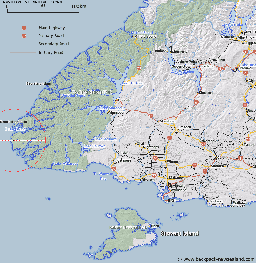
Map showing location of Newton River


LINZ description: Stream with it's mouth is half a mile south of West cape, between Dusky Sound and Chalky Inlet, flows from Lake Fraser.
Latitude: -45.890272
Longitude: 166.474443
Northing: 4897400
Easting: 1093747.6
Land District: Southland
Feat Type: Stream


Scroll down to see a more detailed road map and below that a topographical map showing the location of Newton River. The road map has been supplied by openstreetmap and the topographical map of Newton River has been supplied by Land Information New Zealand (LINZ).

Yes you can use the top static map for you school/university project or personal website with a link back. Contact me for any commercial use.

Newton River Map New Zealand


New Zealand places in our database
[ A ] [ B ] [ C ] [ D ] [ E ] [ F ] [ G ] [ H ] [ I ] [ J ] [ K ] [ L ] [ M ] [ N ] [ O ] [ P ] [ Q ] [ R ] [ S ] [ T ] [ U ] [ V ] [ W ] [ X ] [ Y ] [ Z ]


Closest 20 Streams to Newton River

Grainger Stream ( 11.12km )   Shallow Creek ( 11.26km )   Cook Stream ( 12.74km )   Kohe Creek ( 18.83km )   Lumaluma Creek ( 23.01km )   Left Hand Branch ( 23.01km )   Flood Creek ( 24.34km )   Carrick River ( 24.34km )   Shag River ( 25.57km )   No. 4 Creek ( 27.48km )   No. 3 Creek ( 27.87km )   Oho Creek ( 28.02km )   No. 2 Creek ( 28.67km )   No. 1 Creek ( 29.11km )   Digger Creek ( 30.84km )   Blacklock Stream ( 31.06km )   Sealers No 1 Creek ( 32.04km )   Sealers No 2 Creek ( 32.88km )   Dawson Burn ( 32.95km )   Gray River ( 33km )   Margaret Stream ( 33.88km )   Macnamara Creek ( 33.91km )   Jeanie Burn ( 34.48km )   Wilson River ( 34.9km )   Mike River ( 34.97km )   Occasional Cove ( 35.33km )   Big River ( 36.24km )   Kiwi Burn ( 36.36km )   Richard Burn ( 37.09km )   Cavendish River ( 37.27km )   Dunlop Stream ( 37.56km )   Gold Burn West Branch ( 37.61km )   Coal Burn ( 37.79km )   Gold Burn East Branch ( 38.63km )   Long Burn ( 39.81km )   Gold Burn ( 40km )   Hilda Burn ( 41.1km )   Grace Burn ( 42.06km )   Andrew Burn ( 43.37km )   Fred Burn ( 44.97km )