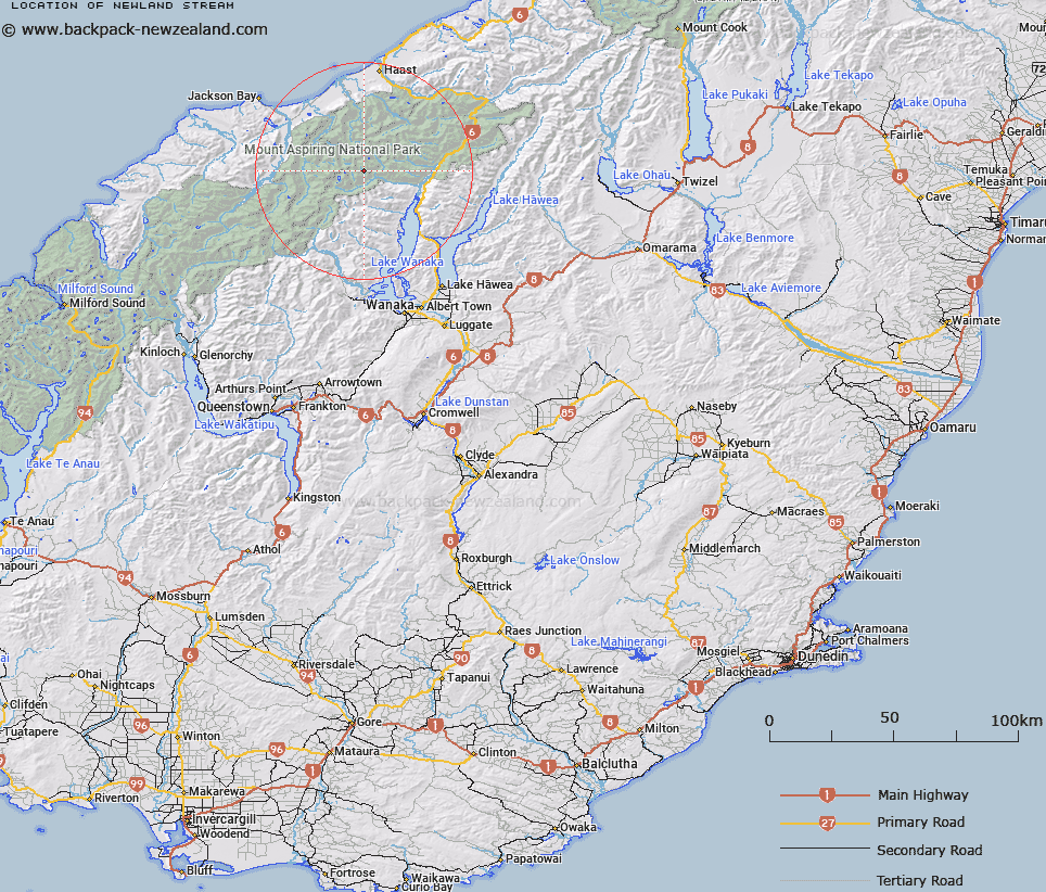
Map showing location of Newland Stream


LINZ description: Between Mts. Kuri and Oblong. Stream is tributary of Wilkin River. Wilkin Survey District.
Latitude: -44.218681
Longitude: 168.985094
Northing: 5095995.3
Easting: 1279285.7
Land District: Otago
Feat Type: Stream


Scroll down to see a more detailed road map and below that a topographical map showing the location of Newland Stream. The road map has been supplied by openstreetmap and the topographical map of Newland Stream has been supplied by Land Information New Zealand (LINZ).

Yes you can use the top static map for you school/university project or personal website with a link back. Contact me for any commercial use.

Newland Stream Map New Zealand


New Zealand places in our database
[ A ] [ B ] [ C ] [ D ] [ E ] [ F ] [ G ] [ H ] [ I ] [ J ] [ K ] [ L ] [ M ] [ N ] [ O ] [ P ] [ Q ] [ R ] [ S ] [ T ] [ U ] [ V ] [ W ] [ X ] [ Y ] [ Z ]


Closest 20 Streams to Newland Stream

Wilkin River ( 3.93km )   Wonderland Stream ( 4.61km )   Siberia Stream ( 6.08km )   Gillespie Stream ( 7.4km )   Wilkin River North Branch ( 7.74km )   Young River South Branch ( 11.16km )   Wilkin River South Branch ( 11.32km )   Kink Creek ( 11.52km )   Stag Creek ( 11.68km )   Spanking Stream ( 11.98km )   Ultima Creek ( 12.69km )   Calliope Creek ( 12.91km )   Dernier Torrent ( 12.99km )   Murray River ( 13.1km )   Craigie Burn ( 13.34km )   Missor Rivulet ( 13.65km )   Tumbling Torrent ( 13.87km )   Albert Burn ( 13.9km )   Mueller River ( 13.98km )   Young River North Branch ( 14.14km )   Chilly Creek ( 14.19km )   Drake River ( 14.31km )   Emily Torrent ( 14.36km )   Te Naihi River ( 14.54km )   Sundown Creek ( 14.61km )   Donald River ( 14.74km )   Flicker Creek ( 14.78km )   Stormwater Stream ( 14.91km )   Turnback Torrent ( 14.94km )   Shale Stream ( 15.04km )   Cramp Creek ( 15.28km )   Cache Stream ( 15.32km )   Jimmy Creek ( 15.87km )   Waterfall Creek ( 16.05km )   Roaring Creek ( 16.07km )   Betsy Jane Creek ( 16.16km )   Young River ( 16.22km )   Stormy Rivulet ( 16.23km )   Taffy Creek ( 16.3km )   Bonar River ( 16.31km )