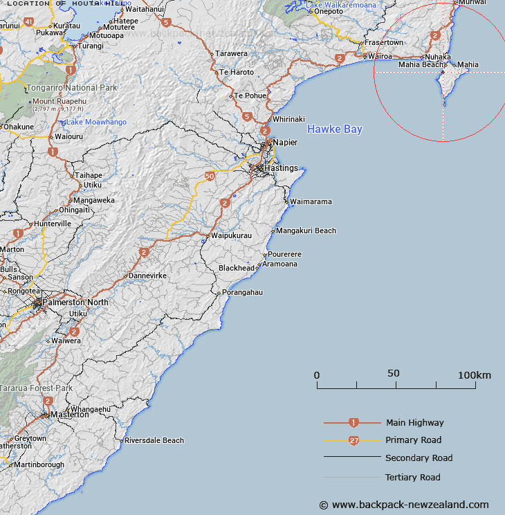
Map showing location of Mouta Hill


LINZ description: On the west of Mahia Peninsula at 204m height north of Moemoto Bay.
Latitude: -39.123175
Longitude: 177.858743
Northing: 5658300
Easting: 2020100
Land District: Hawke's Bay
Feat Type: Hill


Scroll down to see a more detailed road map and below that a topographical map showing the location of Mouta Hill. The road map has been supplied by openstreetmap and the topographical map of Mouta Hill has been supplied by Land Information New Zealand (LINZ).

Yes you can use the top static map for you school/university project or personal website with a link back. Contact me for any commercial use.

Mouta Hill Map New Zealand


New Zealand places in our database
[ A ] [ B ] [ C ] [ D ] [ E ] [ F ] [ G ] [ H ] [ I ] [ J ] [ K ] [ L ] [ M ] [ N ] [ O ] [ P ] [ Q ] [ R ] [ S ] [ T ] [ U ] [ V ] [ W ] [ X ] [ Y ] [ Z ]


Closest 20 Hills to Mouta Hill

Ohiti ( 11.34km )   Mahanga ( 12.79km )   Rakauwhakatangitangi ( 13.5km )   Taumataoriaki ( 15.06km )   Paokuhukura ( 16.42km )   Morere Hill ( 19.21km )   Hiwera ( 24.36km )   Pukeorapa ( 24.5km )   Hurukino ( 25.22km )   Te Kainga ( 26.1km )   Ahimanawa ( 26.56km )   Puketapu ( 27.27km )   Tangihanga ( 27.64km )   Opurua ( 27.79km )   Pukeronui ( 29.32km )   Whareongaonga ( 29.51km )   Te Kaihekiapanui ( 30.34km )   Oraki ( 30.4km )   Tirotirowhitu ( 30.55km )   Pukehoe ( 31.11km )   Te Rimuomaru ( 31.15km )   Whakaumu ( 31.4km )   Kopua ( 31.5km )   Pukaroronui ( 31.84km )   Taungaruawahine ( 32.01km )   Kohitane ( 35.5km )   Taranaki ( 36.32km )   Paparitu ( 37.59km )   Te Houopuanga ( 37.68km )   Kahuitara ( 38.32km )   Ohinemaemae ( 39.06km )   Tipua ( 39.89km )   Te Hiwera ( 40.26km )   Takarangi ( 40.69km )   Te Kuri ( 41.79km )   Wairoa ( 42.98km )   Ahimanu ( 43.75km )   Parikanapa ( 43.75km )   Te Haranga ( 44.38km )   Te Apiti ( 44.8km )