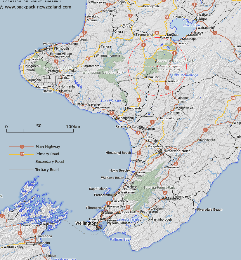
Map showing location of Mount Ruapehu


LINZ description: This name refers to the highest peak and the mountain mass as a whole
Latitude: -39.281204
Longitude: 175.566915
Northing: 5648876
Easting: 1821406
Land District: Wellington
Feat Type: Hill


Scroll down to see a more detailed road map and below that a topographical map showing the location of Mount Ruapehu. The road map has been supplied by openstreetmap and the topographical map of Mount Ruapehu has been supplied by Land Information New Zealand (LINZ).

Yes you can use the top static map for you school/university project or personal website with a link back. Contact me for any commercial use.

Mount Ruapehu Map New Zealand


New Zealand places in our database
[ A ] [ B ] [ C ] [ D ] [ E ] [ F ] [ G ] [ H ] [ I ] [ J ] [ K ] [ L ] [ M ] [ N ] [ O ] [ P ] [ Q ] [ R ] [ S ] [ T ] [ U ] [ V ] [ W ] [ X ] [ Y ] [ Z ]


Closest 20 Hills to Mount Ruapehu

Pyramid Peak ( 0.15km )   Dome ( 0.74km )   Paretetaitonga ( 0.97km )   Tahurangi ( 0.99km )   Ringatoto Peak ( 1.2km )   Glacier Knob ( 1.34km )   Tukino Peak ( 1.78km )   Girdlestone Peak ( 1.82km )   Te Heuheu ( 1.95km )   Te Kohatu ( 4.52km )   Saddle Cone ( 6.26km )   Tufa ( 7.62km )   Hyde ( 10.87km )   Hauhungatahi ( 12.05km )   Tama ( 12.58km )   Wharepu ( 12.9km )   Pukekaikiore ( 14.47km )   Mount Ngauruhoe ( 14.86km )   Pukeonake ( 15.3km )   Makahikatoa ( 16.88km )   Raetihi ( 17.31km )   Waihohonu ( 17.45km )   Mount Tongariro ( 17.82km )   Rongokaupo ( 18.57km )   Mangaio ( 19.08km )   Rotopaunga ( 19.81km )   Marie ( 19.93km )   Okupata ( 20.5km )   Te Mari ( 20.62km )   Oturere ( 20.77km )   The Needles ( 20.85km )   Karewarewa ( 20.99km )   Waitangi ( 21.37km )   Waipahihi ( 21.56km )   Rata ( 22.12km )   Manukaiapu ( 22.4km )   Te Waro ( 22.95km )   Ngamutu ( 23.11km )   Tunupu ( 23.32km )   Te Rotete ( 23.43km )