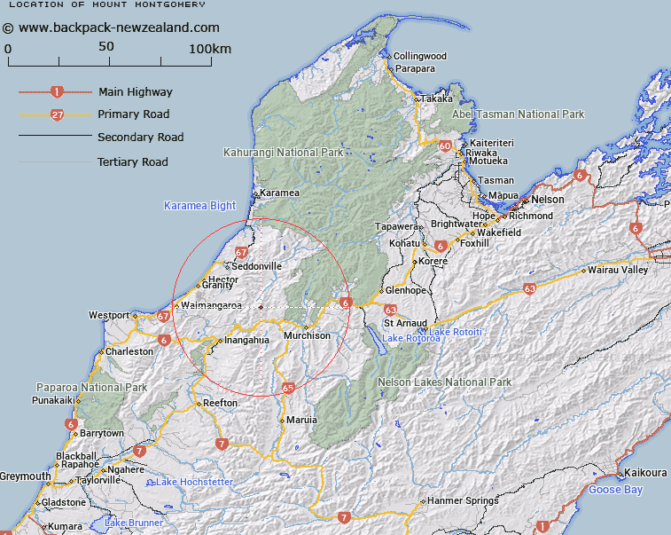
Map showing location of Mount Montgomery


LINZ description: About one mile north-east of Bald Hill Trig
Latitude: -41.714993
Longitude: 172.128465
Northing: 5381500
Easting: 1527500
Land District: Nelson
Feat Type: Hill


Scroll down to see a more detailed road map and below that a topographical map showing the location of Mount Montgomery. The road map has been supplied by openstreetmap and the topographical map of Mount Montgomery has been supplied by Land Information New Zealand (LINZ).

Yes you can use the top static map for you school/university project or personal website with a link back. Contact me for any commercial use.

Mount Montgomery Map New Zealand


New Zealand places in our database
[ A ] [ B ] [ C ] [ D ] [ E ] [ F ] [ G ] [ H ] [ I ] [ J ] [ K ] [ L ] [ M ] [ N ] [ O ] [ P ] [ Q ] [ R ] [ S ] [ T ] [ U ] [ V ] [ W ] [ X ] [ Y ] [ Z ]


Closest 20 Hills to Mount Montgomery

Rocky Tor ( 0.97km )   Bald Hill ( 1.8km )   Mount Lyell ( 7.2km )   Mount Vaughan ( 7.25km )   Eight Mile Hill ( 9.25km )   Mount Berners ( 10.94km )   Mount Newton ( 12.58km )   Sphinx ( 14.19km )   Isolated Hill ( 14.85km )   Mount Glasgow ( 15.28km )   Matiri Hill ( 15.95km )   Rain Peak ( 16.07km )   Boundary Peak ( 16.22km )   Mount Brown ( 16.49km )   Mount Stockton ( 18.56km )   Mount Allman ( 19.69km )   Beeres Rock ( 19.99km )   Mount Curtis ( 21.2km )   Mount Misery ( 21.37km )   Mount Courtney ( 21.68km )   Mount Snodgrass ( 21.81km )   Rosemount ( 22.56km )   Mount Augustus ( 22.94km )   Mount Waller ( 23.18km )   Mount Frederick ( 23.43km )   Kilmarnock ( 23.64km )   The Needle ( 23.67km )   The Haystack ( 23.81km )   Blue Rock ( 24.89km )   Mount William ( 25.7km )   Puke ( 26.33km )   Ben Murray ( 26.43km )   Mount Harte ( 26.68km )   Mount Wynn ( 27.07km )   Mount O'Connor ( 27.23km )   Mount Young ( 27.82km )   Mount Webb ( 28.27km )   Noels Peak ( 28.73km )   Trent Peak ( 29.54km )   Old Man of the Buller ( 29.78km )