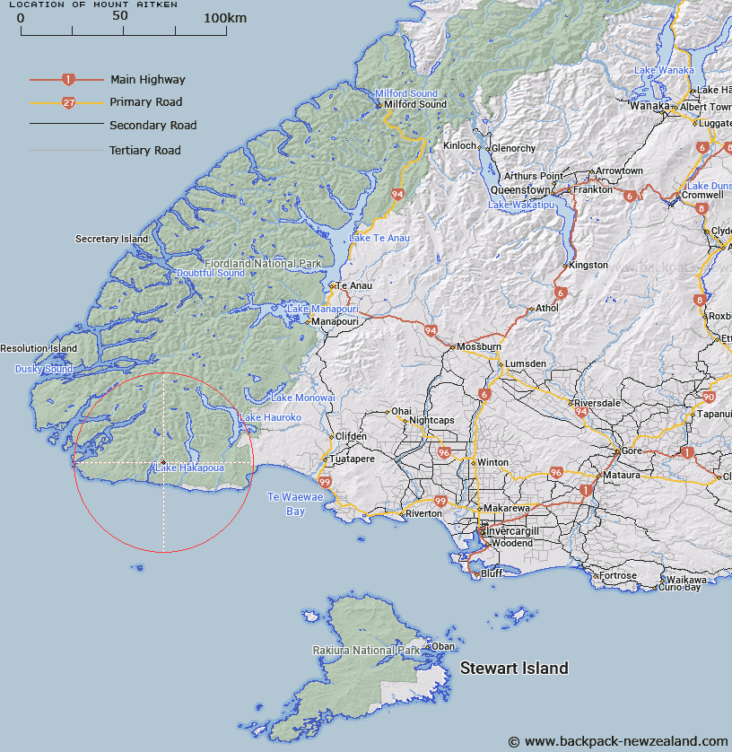
Map showing location of Mount Aitken
LINZ description: Mountain South-western extremity of the South Island, height 1189 m, east of Lake Hakapoua and south-west of Lake Poteriteri. Topo50 map CF06 - Lake Poteriteri, GR 365 731. Geodetic mark, coded A0AH, named ‘T MT AITKEN’, not beaconed, is located at the summit.
Latitude: -46.13763
Longitude: 166.999376
Northing: 4873131
Easting: 1136545
Land District: Southland
Feat Type: Hill
Latitude: -46.13763
Longitude: 166.999376
Northing: 4873131
Easting: 1136545
Land District: Southland
Feat Type: Hill

Scroll down to see a more detailed road map and below that a topographical map showing the location of Mount Aitken. The road map has been supplied by openstreetmap and the topographical map of Mount Aitken has been supplied by Land Information New Zealand (LINZ).
Yes you can use the top static map for you school/university project or personal website with a link back. Contact me for any commercial use.
[ A ] [ B ] [ C ] [ D ] [ E ] [ F ] [ G ] [ H ] [ I ] [ J ] [ K ] [ L ] [ M ] [ N ] [ O ] [ P ] [ Q ] [ R ] [ S ] [ T ] [ U ] [ V ] [ W ] [ X ] [ Y ] [ Z ]