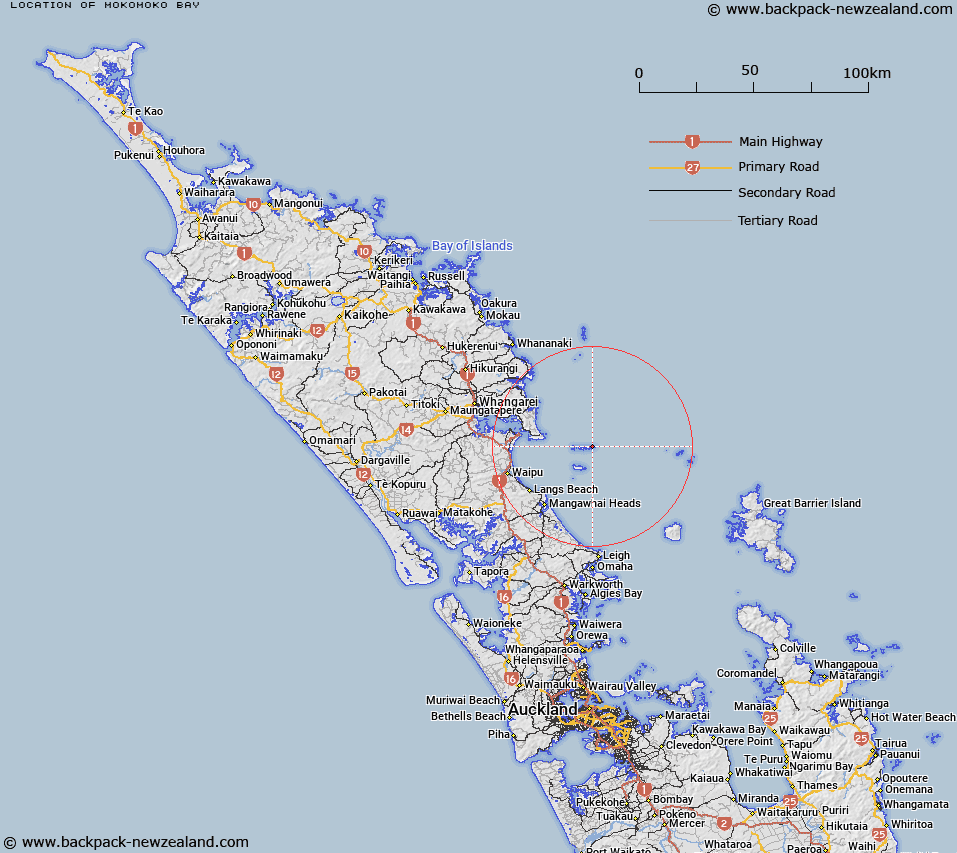
Map showing location of Mokomoko Bay


LINZ description: Bay on northern coast of Coppermine Island in the Hen and Chickens Islands, across narrowest part of the island from The Landing.
Latitude: -35.886055
Longitude: 174.774326
Northing: 6027235.7
Easting: 1760153.6
Land District: North Auckland
Feat Type: Bay


Scroll down to see a more detailed road map and below that a topographical map showing the location of Mokomoko Bay. The road map has been supplied by openstreetmap and the topographical map of Mokomoko Bay has been supplied by Land Information New Zealand (LINZ).

Yes you can use the top static map for you school/university project or personal website with a link back. Contact me for any commercial use.

Mokomoko Bay Map New Zealand


New Zealand places in our database
[ A ] [ B ] [ C ] [ D ] [ E ] [ F ] [ G ] [ H ] [ I ] [ J ] [ K ] [ L ] [ M ] [ N ] [ O ] [ P ] [ Q ] [ R ] [ S ] [ T ] [ U ] [ V ] [ W ] [ X ] [ Y ] [ Z ]


Closest 20 Bays to Mokomoko Bay

The Landing ( 0.27km )   Taupata Bay ( 0.43km )   Tawatawa Bay ( 0.58km )   Maire Bay ( 0.74km )   Merrick Bay ( 1.09km )   Koarea Bay ( 1.32km )   Starfish Bay ( 2.22km )   Boulder Bay ( 2.57km )   Korimako Bay ( 3.79km )   Dolphin Bay ( 3.89km )   South Cove ( 4.26km )   West Bay ( 5.19km )   Wilson Bay ( 10.32km )   Stead Bay ( 10.53km )   Wahine Bay ( 10.55km )   Lighthouse Bay ( 10.92km )   Reischek Bay ( 10.93km )   Dragon Mouth Cove ( 11.03km )   Sibson Bay ( 11.05km )   Pukanui Bay ( 11.21km )   Peach Cove ( 19.43km )   Smugglers Bay ( 21.77km )   Urquharts Bay ( 22.64km )   McKenzie Bay ( 22.86km )   Taurikura Bay ( 23.16km )   McGregors Bay ( 24.02km )   Bream Bay ( 24.68km )   Little Munroe Bay ( 24.8km )   Awahoa Bay ( 25.26km )   Andersons Cove ( 25.82km )   Taiharuru Bay ( 26.42km )   Otauhaunui Bay ( 26.43km )   McLeod Bay ( 26.51km )   Reotahi Bay ( 26.67km )   McKenzie Cove ( 27.63km )   Marsden Bay ( 27.86km )   Munro Bay ( 28.13km )   Waipu Cove ( 28.75km )   Mangawhai Harbour ( 28.81km )   Mangawai Harbour ( 28.81km )