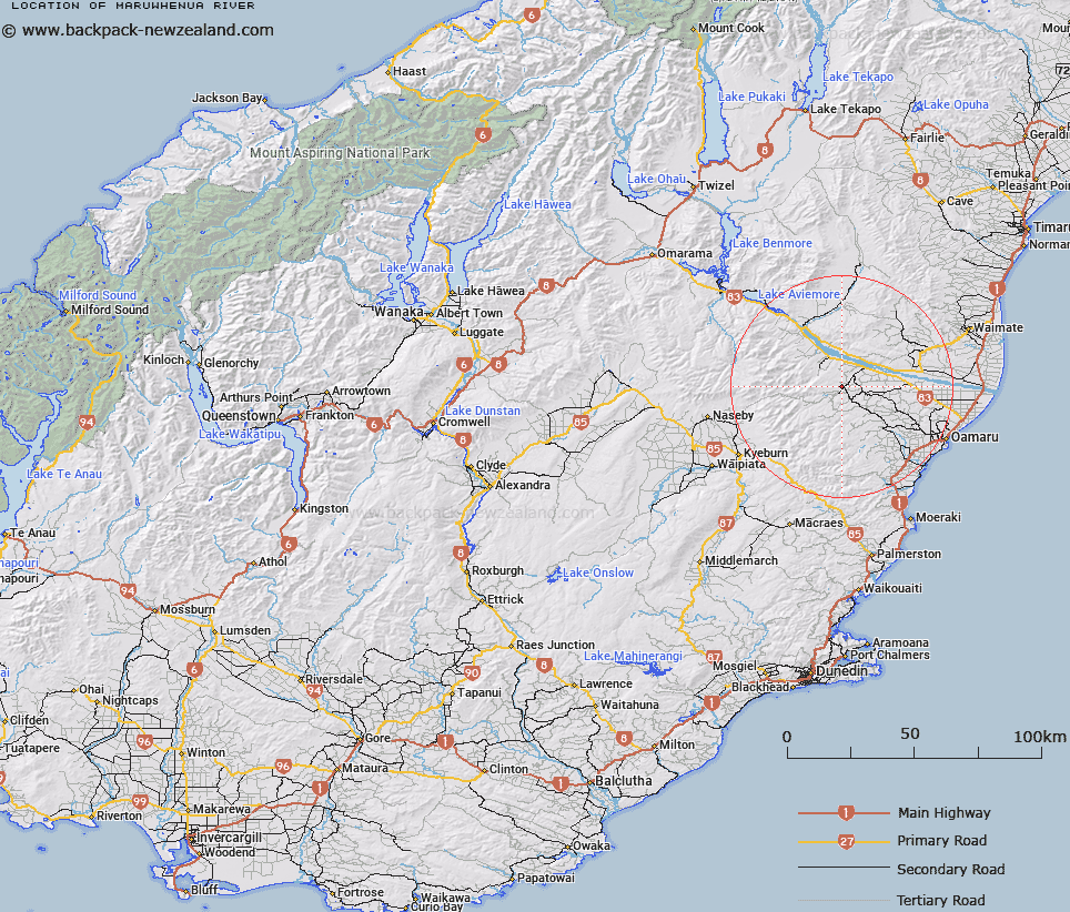
Map showing location of Maruwhenua River


LINZ description: Tributary of the Waitaki River with it's sources in the Kakanui Mountains under Mounts Pisgah and Nobbler. Maerewhenua Survey District.
Latitude: -44.923321
Longitude: 170.610674
Northing: 5022790.3
Easting: 1411433.3
Land District: Otago
Feat Type: Stream


Scroll down to see a more detailed road map and below that a topographical map showing the location of Maruwhenua River. The road map has been supplied by openstreetmap and the topographical map of Maruwhenua River has been supplied by Land Information New Zealand (LINZ).

Yes you can use the top static map for you school/university project or personal website with a link back. Contact me for any commercial use.

Maruwhenua River Map New Zealand


New Zealand places in our database
[ A ] [ B ] [ C ] [ D ] [ E ] [ F ] [ G ] [ H ] [ I ] [ J ] [ K ] [ L ] [ M ] [ N ] [ O ] [ P ] [ Q ] [ R ] [ S ] [ T ] [ U ] [ V ] [ W ] [ X ] [ Y ] [ Z ]


Closest 20 Streams to Maruwhenua River

Bushy Creek ( 2.67km )   Waimihi Creek ( 3.66km )   Sheepwash Creek ( 4.18km )   Waipati Creek ( 6.13km )   Karara Creek ( 6.34km )   Home Creek ( 6.92km )   Ben Lomond Creek ( 7.54km )   Waikaura Creek ( 7.84km )   Gorge Creek ( 7.93km )   Thompsons Creek ( 8.38km )   Awamoko Stream ( 8.76km )   Tewatapoki Creek ( 8.94km )   Rotten Creek ( 9.01km )   Bushy Creek ( 9.35km )   Kokoamu Creek ( 9.37km )   Kokoamo Creek ( 9.37km )   Gully Creek ( 9.84km )   Chinamans Creek ( 10km )   Slaty Stream ( 10.89km )   Belmont Stream ( 10.92km )   Otekaike River ( 10.94km )   Otekaieke River ( 10.94km )   Newsomes Creek ( 11.28km )   Doctors Creek ( 11.65km )   Pass Creek ( 12.22km )   Jacksons Creek ( 12.54km )   South Branch Maerewhenua River ( 12.56km )   Penticotico Stream ( 12.66km )   Waitaki River ( 13.34km )   Mole Hill Creek ( 13.74km )   Waitoura Creek ( 13.87km )   Black Point Creek ( 14.14km )   Otiake River ( 14.16km )   Bobbing Creek ( 14.53km )   Stony Creek ( 15.25km )   Windsor Stream ( 15.99km )   Malcolms Creek ( 16.05km )   Sandstone Creek ( 16.24km )   North Branch Maerewhenua River ( 16.37km )   Fuchsia Creek ( 16.78km )