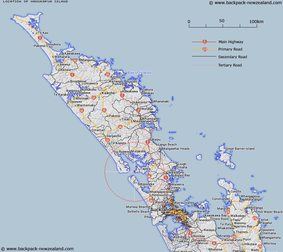
Map showing location of Manukapua Island


LINZ description: Accepted that feature has no description; to be captured at a later date. Section 114 and Schedule 14 Te Uri o Hau Claims Settlement Act 2002.
Latitude: -36.383155
Longitude: 174.243212
Northing: 5972835.1
Easting: 1711505.8
Land District: North Auckland
Feat Type: Island


Scroll down to see a more detailed road map and below that a topographical map showing the location of Manukapua Island. The road map has been supplied by openstreetmap and the topographical map of Manukapua Island has been supplied by Land Information New Zealand (LINZ).

Yes you can use the top static map for you school/university project or personal website with a link back. Contact me for any commercial use.

Manukapua Island Map New Zealand


New Zealand places in our database
[ A ] [ B ] [ C ] [ D ] [ E ] [ F ] [ G ] [ H ] [ I ] [ J ] [ K ] [ L ] [ M ] [ N ] [ O ] [ P ] [ Q ] [ R ] [ S ] [ T ] [ U ] [ V ] [ W ] [ X ] [ Y ] [ Z ]


Closest 20 Islands to Manukapua Island

T?pare Island ( 7.05km )   Motuouhi Island ( 10.72km )   Moturoa Island ( 11.04km )   Moturemu Island ( 14.04km )   Ngamotu Island ( 15.88km )   Kaiwhitu Island ( 16.9km )   Titipu Island ( 19.01km )   Pupuia Island ( 19.37km )   Motutere Island ( 23.58km )   Motukuru Island ( 27.67km )   Waikauri Island ( 27.84km )   Puharakeke Island ( 28.36km )   Opahekeheke Island ( 28.98km )   Grants Island ( 44.13km )   Casnell Island ( 44.81km )   Pudding Island ( 45.97km )   Mahurangi Island ( 46.07km )   Brazier Rock ( 46.41km )   Crocodile Island ( 46.55km )   Te Motu-o-Marae-Ariki ( 46.55km )   Te Haupa Island ( 47.3km )   Horseshoe Island ( 47.57km )   Mayne Islands ( 48.5km )   Moturekareka Island ( 49.18km )   Rabbit Island ( 49.34km )   Takangaroa Island ( 49.52km )   Goat Island ( 49.52km )   Martello Rock (Ruakoura) ( 49.78km )   Motutara Island ( 50.1km )   Rocky Islets ( 50.39km )   Te H?were-a-Maki / Goat Island ( 51.37km )   Goat Island ( 51.37km )   Motuora Island ( 51.4km )   Motuketekete Island ( 51.51km )   Pembles Island (Tangaroa) ( 51.85km )   Beehive Island (Taungamaro Island) ( 52.24km )   Panetiki Island (The Outpost) ( 52.59km )   Motutara Island ( 52.61km )   Oaia Island ( 53.02km )   Archway Island ( 53.61km )