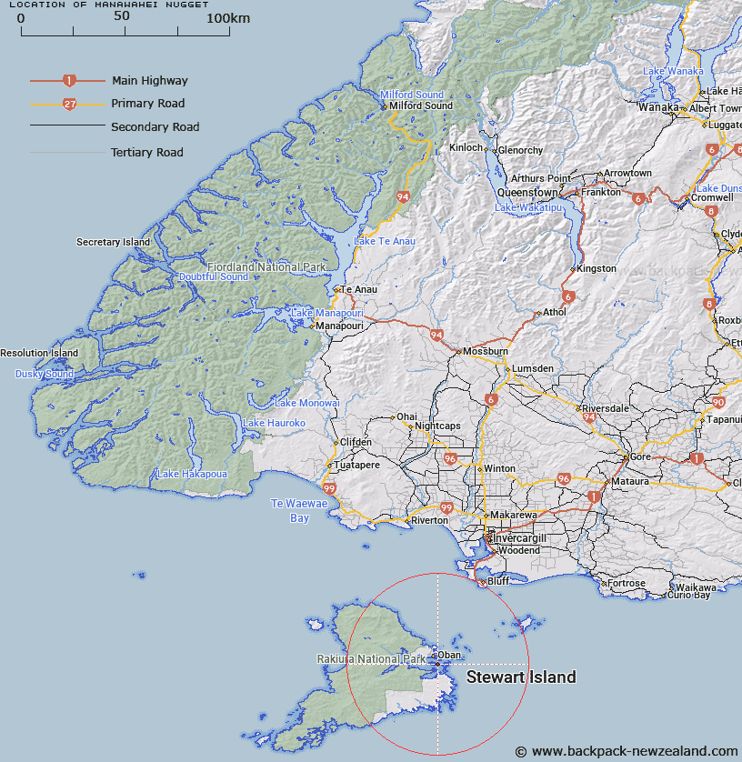
Map showing location of Manawahei Nugget


LINZ description: Rock off North coast of East End of Ulva Island, 1km East of Sydney Cove. Paterson Inlet, Stewart Island. Paterson Survey District.
Latitude: -46.930992
Longitude: 168.147352
Northing: 4791064.3
Easting: 1230629.5
Land District: Southland
Feat Type: Rock


Scroll down to see a more detailed road map and below that a topographical map showing the location of Manawahei Nugget. The road map has been supplied by openstreetmap and the topographical map of Manawahei Nugget has been supplied by Land Information New Zealand (LINZ).

Yes you can use the top static map for you school/university project or personal website with a link back. Contact me for any commercial use.

Manawahei Nugget Map New Zealand


New Zealand places in our database
[ A ] [ B ] [ C ] [ D ] [ E ] [ F ] [ G ] [ H ] [ I ] [ J ] [ K ] [ L ] [ M ] [ N ] [ O ] [ P ] [ Q ] [ R ] [ S ] [ T ] [ U ] [ V ] [ W ] [ X ] [ Y ] [ Z ]


Closest 20 Rocks to Manawahei Nugget

Pipi Rocks ( 1.48km )   One Tree Rock ( 2.07km )   Blancmange Rock ( 2.56km )   Moses Nugget ( 2.63km )   Pillar Rock ( 3.33km )   Observation Rock ( 3.63km )   Big Rock ( 4km )   Kaiaho Rock ( 4.17km )   Kaiapo Rock ( 4.17km )   Passage Rock ( 4.8km )   Whero Rock ( 4.8km )   Flat Rock ( 8.78km )   White Rocks ( 21.44km )   Devils Punchbowl ( 21.44km )   Orphans Rock ( 42.22km )   The Knobbies ( 46.55km )   Pigeon House ( 49.78km )   Micrometer Rock and Reef ( 50.14km )   Halfway Rocks ( 51.38km )   Hapuka Rock ( 57.53km )   Pierced Stack ( 102.6km )   Harts Rock ( 119.45km )   Craig Rankin ( 123.19km )   Castle Rock ( 124.72km )   Remarkable Rock ( 125.06km )   Tunnel Rocks ( 128.38km )   Tokata Point ( 138.58km )   Mitchells Rocks ( 157.7km )   Cooks Head ( 168.6km )   Titan Rocks ( 168.76km )   Pompis Pillar ( 169km )   Castle Rock ( 169.12km )   Passage Rock ( 171.19km )   Dumbarton Rock ( 174.51km )   The Three Brothers ( 178.12km )   Carsons Rock ( 178.74km )   The Stoneman ( 180.72km )   Lammerlaw Rock ( 181.79km )   Halfway Rock ( 184.93km )   The Ship at Anchor ( 186.83km )