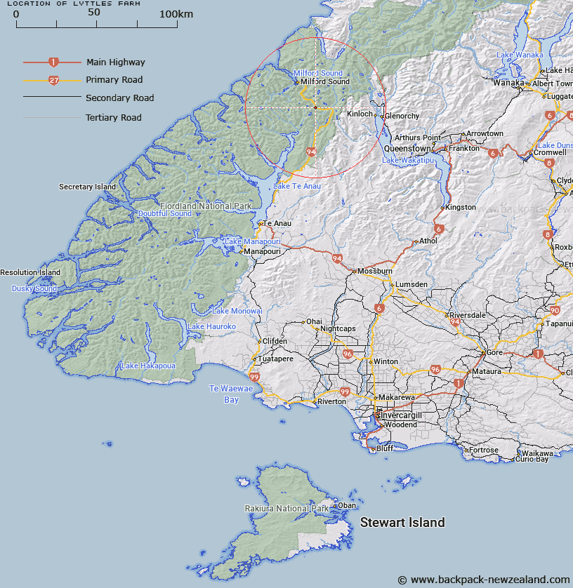
Map showing location of Lyttles Farm


LINZ description: Located on Hollyford River, 2km south-west of MT Christina
Latitude: -44.802859
Longitude: 168.025658
Northing: 5026900
Easting: 1206600
Land District: Southland
Feat Type: Locality


Scroll down to see a more detailed road map and below that a topographical map showing the location of Lyttles Farm. The road map has been supplied by openstreetmap and the topographical map of Lyttles Farm has been supplied by Land Information New Zealand (LINZ).

Yes you can use the top static map for you school/university project or personal website with a link back. Contact me for any commercial use.

Lyttles Farm Map New Zealand


New Zealand places in our database
[ A ] [ B ] [ C ] [ D ] [ E ] [ F ] [ G ] [ H ] [ I ] [ J ] [ K ] [ L ] [ M ] [ N ] [ O ] [ P ] [ Q ] [ R ] [ S ] [ T ] [ U ] [ V ] [ W ] [ X ] [ Y ] [ Z ]


Closest 20 Localitys to Lyttles Farm

Hollyford ( 10.28km )   Cascade Creek ( 11.34km )   Milford Sound ( 16.5km )   Kinloch ( 25.96km )   Paradise ( 28.14km )   Glenorchy ( 29km )   Birchdale ( 29.71km )   Greenstone ( 29.76km )   Rees Valley ( 30.9km )   Elfin Bay ( 31.61km )   Mount Creighton ( 39.21km )   Jamestown ( 44.83km )   Mount Nicholas ( 44.95km )   Bullendale (The Reefs) ( 51.46km )   Charlestown ( 51.72km )   Skippers ( 51.92km )   Arthurs Point ( 54.93km )   Kelvin Heights ( 58.98km )   Kelvin Peninsula ( 58.98km )   Wharehuanui ( 60.07km )   Kawarau Falls ( 60.52km )   The Dale ( 60.57km )   Lower Shotover ( 61.16km )   Macetown ( 62.91km )   Douglasvale ( 63.92km )   Arrowtown ( 65.24km )   Te Anau ( 72.25km )   Gibbston ( 77.31km )   Cardrona ( 77.62km )   Glendhu Bay ( 79.54km )   Kingston ( 80.13km )   The Key ( 83.18km )   Nevis Crossing ( 86.82km )   Lower Nevis ( 87.16km )   Athol ( 89.61km )   Garston ( 90.08km )   Manapouri ( 90.73km )   Parawa ( 91.37km )   Kawarau Gorge ( 91.72km )   Mount Barker ( 91.8km )