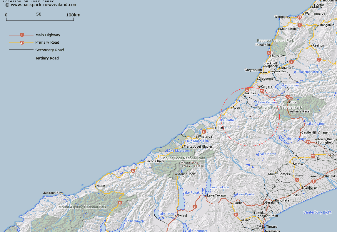
Map showing location of Lyes Creek


LINZ description: Feature shown on: NZMS260 J34 Edition 1 1992 Limited Revision 1996
Latitude: -43.008333
Longitude: 171.062972
Northing: 5236439.2
Easting: 1442135.3
Land District: Westland
Feat Type: Stream


Scroll down to see a more detailed road map and below that a topographical map showing the location of Lyes Creek. The road map has been supplied by openstreetmap and the topographical map of Lyes Creek has been supplied by Land Information New Zealand (LINZ).

Yes you can use the top static map for you school/university project or personal website with a link back. Contact me for any commercial use.
Lyes Creek Map New Zealand


New Zealand places in our database
[ A ] [ B ] [ C ] [ D ] [ E ] [ F ] [ G ] [ H ] [ I ] [ J ] [ K ] [ L ] [ M ] [ N ] [ O ] [ P ] [ Q ] [ R ] [ S ] [ T ] [ U ] [ V ] [ W ] [ X ] [ Y ] [ Z ]


Closest 20 Streams to Lyes Creek

Serpentine Creek ( 0.82km )   Whitehorn Creek ( 2.13km )   Moose Creek ( 2.22km )   Bonar Creek ( 2.52km )   Nogo Creek ( 2.86km )   Inframeta Creek ( 2.97km )   Jap Creek ( 3.1km )   Harry Creek ( 3.2km )   Diedrichs Creek ( 3.21km )   Diedrich Creek ( 3.21km )   New Year Creek ( 3.43km )   Dick Creek ( 3.56km )   Transport Creek ( 3.77km )   Tom Creek ( 4.38km )   Swag Creek ( 4.41km )   Darby Creek ( 4.92km )   Detour Creek ( 5km )   Theta Creek ( 5.04km )   Collier Creek ( 5.23km )   Caput Creek ( 5.26km )   Director Creek ( 5.28km )   Frew Creek ( 5.38km )   Bluff Creek ( 5.39km )   Muriel Creek ( 5.4km )   Saddle Creek ( 5.43km )   Brow Creek ( 5.7km )   Mullins Creek ( 5.9km )   Granite Creek ( 6.02km )   Sunbeam Creek ( 6.09km )   Jumble Creek ( 6.1km )   Marcus Creek ( 6.19km )   Poet Creek ( 6.28km )   Haricot Creek ( 6.43km )   Boojum Creek ( 6.5km )   Harrop Creek ( 6.52km )   Rapid Creek ( 6.58km )   Snark Creek ( 6.75km )   Illusion Creek ( 6.84km )   Carl Creek ( 6.87km )   Spell Creek ( 6.97km )