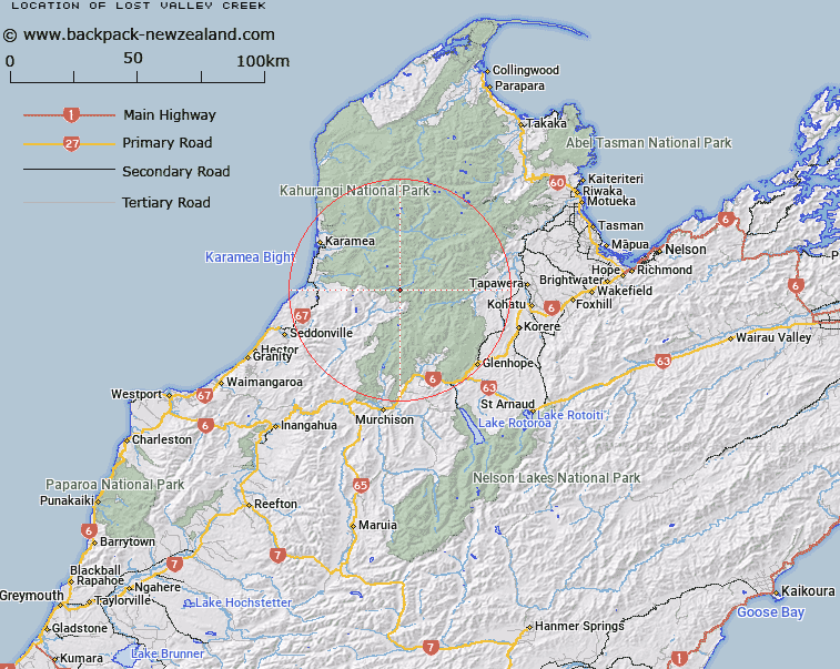
Map showing location of Lost Valley Creek


LINZ description: Small right bank tributary of the Karamea River, entering the Karamea River 1.2km below the Taipo/ Karamea River junction. Leslie Survey District.
Latitude: -41.402292
Longitude: 172.383885
Northing: 5416400
Easting: 1548500
Land District: Nelson
Feat Type: Stream


Scroll down to see a more detailed road map and below that a topographical map showing the location of Lost Valley Creek. The road map has been supplied by openstreetmap and the topographical map of Lost Valley Creek has been supplied by Land Information New Zealand (LINZ).

Yes you can use the top static map for you school/university project or personal website with a link back. Contact me for any commercial use.

Lost Valley Creek Map New Zealand


New Zealand places in our database
[ A ] [ B ] [ C ] [ D ] [ E ] [ F ] [ G ] [ H ] [ I ] [ J ] [ K ] [ L ] [ M ] [ N ] [ O ] [ P ] [ Q ] [ R ] [ S ] [ T ] [ U ] [ V ] [ W ] [ X ] [ Y ] [ Z ]


Closest 20 Streams to Lost Valley Creek

Orbit Creek ( 2.69km )   Waters Creek ( 3.07km )   Kendall Creek ( 3.46km )   Taip? River ( 3.67km )   Herbert Creek ( 3.81km )   Meteor Creek ( 4.05km )   Apollo Creek ( 4.56km )   Stone Creek ( 5.21km )   Mars Creek ( 5.39km )   Lunik Creek ( 5.78km )   Allen River Right Branch ( 6.04km )   Thor Creek ( 6.53km )   Star Creek ( 6.67km )   Pannikin Creek ( 6.79km )   Luna Stream ( 6.79km )   Comet Creek ( 6.91km )   Wangapeka River North Branch ( 7.4km )   Atlas Creek ( 7.72km )   Satellite Creek ( 7.79km )   Allen River Left Branch ( 8.52km )   Winter Creek ( 8.71km )   Kiwi Stream ( 8.77km )   Mercury Creek ( 8.78km )   Apogee Creek ( 8.83km )   Tin Creek ( 9.06km )   Perigee Creek ( 9.72km )   Robson Stream ( 9.74km )   Kinzett Stream ( 9.94km )   Venus Creek ( 9.95km )   Allen River ( 9.95km )   Kiwi Creek ( 10.21km )   Tangent Creek ( 10.35km )   Silver Creek ( 10.99km )   Piano Creek ( 11.14km )   Sputnik Creek ( 11.15km )   Johnson River ( 11.28km )   Gold Creek ( 11.37km )   Copper Creek ( 11.53km )   Hambone Creek ( 11.58km )   McHarrie Creek ( 11.58km )