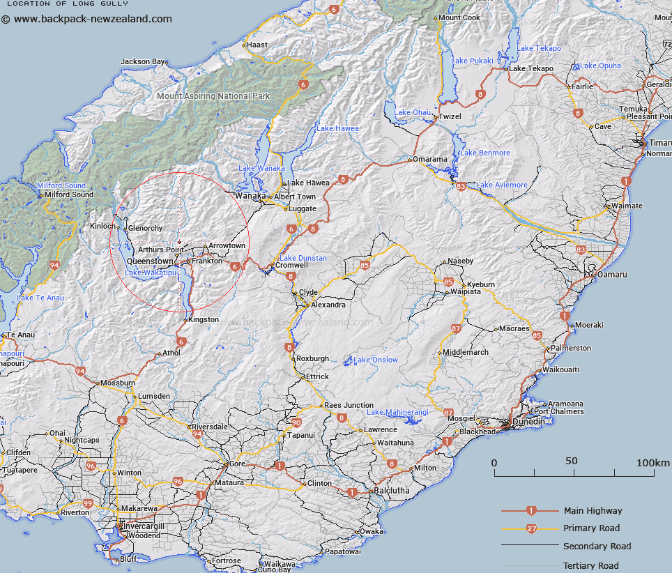
Map showing location of Long Gully


LINZ description: Stream flows through gully into the Shotover River
Latitude: -44.918972
Longitude: 168.686038
Northing: 5016991.2
Easting: 1259513.8
Land District: Otago
Feat Type: Valley


Scroll down to see a more detailed road map and below that a topographical map showing the location of Long Gully. The road map has been supplied by openstreetmap and the topographical map of Long Gully has been supplied by Land Information New Zealand (LINZ).

Yes you can use the top static map for you school/university project or personal website with a link back. Contact me for any commercial use.

Long Gully Map New Zealand


New Zealand places in our database
[ A ] [ B ] [ C ] [ D ] [ E ] [ F ] [ G ] [ H ] [ I ] [ J ] [ K ] [ L ] [ M ] [ N ] [ O ] [ P ] [ Q ] [ R ] [ S ] [ T ] [ U ] [ V ] [ W ] [ X ] [ Y ] [ Z ]


Closest 20 Valleys to Long Gully

Siphon Gully ( 1.37km )   Tyrees Cut ( 4.69km )   Wire Rope Gully ( 4.7km )   Maori Gully ( 5.17km )   Gooseberry Gully ( 5.54km )   Fitzpatrick Gully ( 5.57km )   Horse Gully ( 6.18km )   Deep Gully ( 7.52km )   The Gorge ( 9.82km )   Scanlan Gully ( 10.33km )   Sandhill Cut ( 11.36km )   Davidsons Gully ( 11.53km )   Sawpit Gully ( 11.72km )   Butchers Gully ( 11.97km )   Swipers Gully ( 12.26km )   Pizollis Gully ( 12.84km )   New Chum Gully ( 12.98km )   Rogers Gully ( 14.7km )   Brackens Gully ( 14.72km )   Maori Gully ( 17.37km )   Maori Gully ( 20.16km )   Foxs Gully ( 20.45km )   Maori Gully ( 21.33km )   Roadmans Gully ( 21.97km )   Tyre Gully ( 22.11km )   Wrights Gully ( 23km )   Rodies Gully ( 23.1km )   Woody Gully ( 24.12km )   Green Gully ( 24.32km )   German Gully ( 26.2km )   Black Gorge ( 26.9km )   Tuohys Gully ( 27.26km )   Sixteen Mile Gorge ( 28.23km )   Whiskey Gully ( 28.33km )   Clay Bank Gully ( 28.43km )   Harveys Gully ( 31.99km )   Wide Gully ( 33.57km )   Kawarau Gorge ( 34.21km )   Masons Gully ( 35.85km )   Chinaman Gully ( 36.56km )