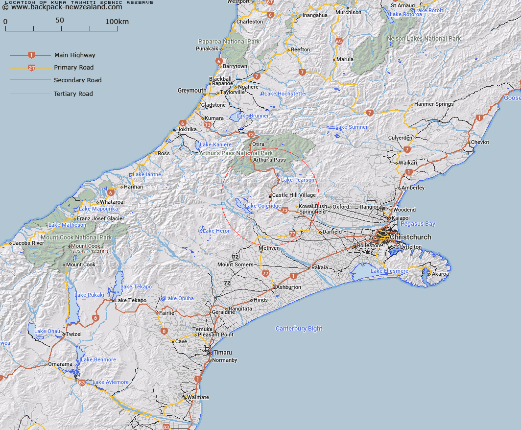
Map showing location of Kura Tāwhiti Scenic Reserve
LINZ description: Initially 54.0496ha being Rural Section 40839, Rural Section 40840 and Lot 2 DP 43207. When reclassified as a Crown Protected Area, Section 3 SO 387006, Section 2 SO 429128, and Lot 1 DP 391171 were added to the Reserve comprising a further 65.134ha.
Latitude: -43.221251
Longitude: 171.71553
Northing: 5213814.4
Easting: 1495680.9
Land District: Canterbury
Feat Type: Scenic Reserve
Latitude: -43.221251
Longitude: 171.71553
Northing: 5213814.4
Easting: 1495680.9
Land District: Canterbury
Feat Type: Scenic Reserve

Scroll down to see a more detailed road map and below that a topographical map showing the location of Kura Tāwhiti Scenic Reserve. The road map has been supplied by openstreetmap and the topographical map of Kura Tāwhiti Scenic Reserve has been supplied by Land Information New Zealand (LINZ).
Yes you can use the top static map for you school/university project or personal website with a link back. Contact me for any commercial use.
[ A ] [ B ] [ C ] [ D ] [ E ] [ F ] [ G ] [ H ] [ I ] [ J ] [ K ] [ L ] [ M ] [ N ] [ O ] [ P ] [ Q ] [ R ] [ S ] [ T ] [ U ] [ V ] [ W ] [ X ] [ Y ] [ Z ]