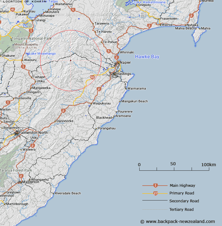
Map showing location of Komata


LINZ description: Point in the Kaikomata Range in between the Timahanga and Ngaruroro Rivers south of Comet Hut.
Latitude: -39.474518
Longitude: 176.291492
Northing: 5625390.2
Easting: 1883132.7
Land District: Hawke's Bay
Feat Type: Hill


Scroll down to see a more detailed road map and below that a topographical map showing the location of Komata. The road map has been supplied by openstreetmap and the topographical map of Komata has been supplied by Land Information New Zealand (LINZ).

Yes you can use the top static map for you school/university project or personal website with a link back. Contact me for any commercial use.

Komata Map New Zealand


New Zealand places in our database
[ A ] [ B ] [ C ] [ D ] [ E ] [ F ] [ G ] [ H ] [ I ] [ J ] [ K ] [ L ] [ M ] [ N ] [ O ] [ P ] [ Q ] [ R ] [ S ] [ T ] [ U ] [ V ] [ W ] [ X ] [ Y ] [ Z ]


Closest 20 Hills to Komata

Te Whata ( 6.38km )   Te Ahimanawa ( 7.62km )   Desolation ( 8.17km )   Kohinga (Bonny Mary) ( 8.28km )   Lessong Monument ( 8.63km )   Miroroa ( 8.69km )   Cattle Hill ( 8.69km )   Desolation Peak ( 8.96km )   Taruarau Hill ( 8.98km )   Otupae ( 9.08km )   Te Turiokanawha ( 9.46km )   Mataipuku ( 9.68km )   Rakautaonga ( 10.43km )   Tikorangi ( 10.73km )   Te Iringa ( 10.86km )   Te Manihi ( 10.89km )   Toimaru ( 11.81km )   Whanawhana (The Fort) ( 12.12km )   Mangaohane ( 12.51km )   Hogget ( 12.79km )   Big Hill ( 12.98km )   Tauwharepokoru ( 13.27km )   Ikawetea ( 13.59km )   Kuripapango Hill ( 13.65km )   Kuripapanga Hill ( 13.65km )   Ohawai ( 13.77km )   Pukewharariki ( 14.43km )   Black Basin ( 14.56km )   Boar Hill ( 14.95km )   Three Fingers ( 15.46km )   Hiwiopapakai ( 16.06km )   Rocky Point ( 16.5km )   The Peak Hill ( 17.61km )   The Tits ( 18.01km )   Makirikiri ( 18.23km )   Moemoe ( 18.32km )   Mount Mary ( 19.42km )   Ohutu ( 19.75km )   Mount Meany ( 19.83km )   Owhaoko ( 20.2km )