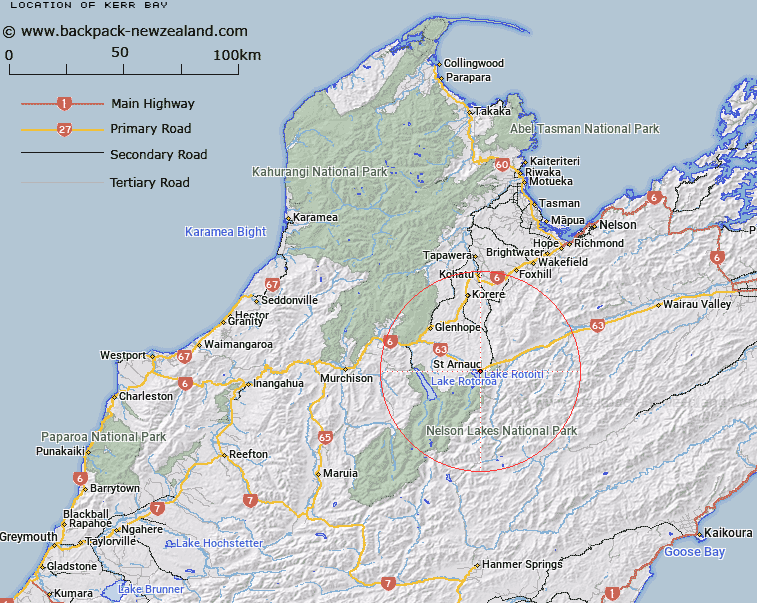
Map showing location of Kerr Bay


LINZ description: The eastern bay at the North end of Lake Rotoiti. Block XIII Motupiko Survey District.
Latitude: -41.809836
Longitude: 172.84443
Northing: 5371325.4
Easting: 1587077.8
Land District: Nelson
Feat Type: Bay


Scroll down to see a more detailed road map and below that a topographical map showing the location of Kerr Bay. The road map has been supplied by openstreetmap and the topographical map of Kerr Bay has been supplied by Land Information New Zealand (LINZ).

Yes you can use the top static map for you school/university project or personal website with a link back. Contact me for any commercial use.

Kerr Bay Map New Zealand


New Zealand places in our database
[ A ] [ B ] [ C ] [ D ] [ E ] [ F ] [ G ] [ H ] [ I ] [ J ] [ K ] [ L ] [ M ] [ N ] [ O ] [ P ] [ Q ] [ R ] [ S ] [ T ] [ U ] [ V ] [ W ] [ X ] [ Y ] [ Z ]


Closest 20 Bays to Kerr Bay

West Bay ( 1.47km )   Waimea Inlet ( 63.44km )   Te Mamaku / Ruby Bay ( 67.74km )   Ruby Bay ( 67.74km )   Nelson Haven ( 73.54km )   Moutere Inlet ( 73.87km )   Tasman Bay / Te Tai-o-Aorere ( 75.37km )   Tasman Bay ( 75.37km )   Tapu Bay ( 85.61km )   Stephens Bay ( 85.79km )   Dummy Bay ( 85.97km )   Kaiteriteri Inlet ( 86.88km )   Cable Bay ( 86.95km )   Rotokura / Cable Bay ( 86.95km )   Breaker Bay ( 87.66km )   Honeymoon Bay ( 87.81km )   Fall Cove ( 87.83km )   Ngaio Bay ( 88.4km )   Pier Cove ( 88.58km )   Towers Bay ( 88.81km )   Echinus Cove ( 89.14km )   Ot?whero Inlet ( 89.48km )   Delaware Bay ( 90.04km )   Sandy Bay ( 90.98km )   Tinline Bay ( 92.35km )   Coquille Bay ( 92.53km )   Apple Tree Bay ( 93.37km )   Goose Bay ( 93.61km )   Stream Cove ( 93.8km )   Half Moon Bay ( 94.12km )   Stilwell Bay ( 94.36km )   Akersten Bay ( 94.69km )   Cyathees Cove ( 95.03km )   Cyathea Cove ( 95.03km )   Karamea Bight ( 95.52km )   Watering Cove ( 95.65km )   Okiwi Bay ( 95.65km )   Waipapa Bay ( 96.07km )   Gooch Bay ( 96.18km )   Anchor Bay ( 96.53km )