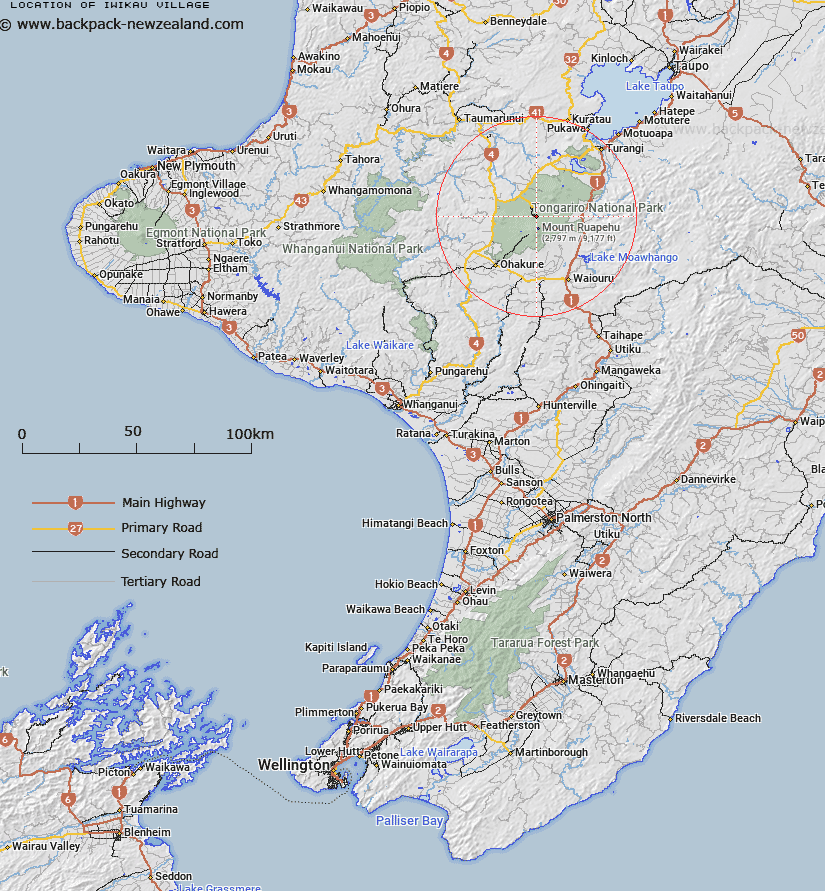
Map showing location of Iwikau Village


LINZ description: On the north-western slopes of Mount Ruapehu.
Latitude: -39.237067
Longitude: 175.556692
Northing: 5653800
Easting: 1820662.6
Land District: Wellington
Feat Type: Locality


Scroll down to see a more detailed road map and below that a topographical map showing the location of Iwikau Village. The road map has been supplied by openstreetmap and the topographical map of Iwikau Village has been supplied by Land Information New Zealand (LINZ).

Yes you can use the top static map for you school/university project or personal website with a link back. Contact me for any commercial use.

Iwikau Village Map New Zealand


New Zealand places in our database
[ A ] [ B ] [ C ] [ D ] [ E ] [ F ] [ G ] [ H ] [ I ] [ J ] [ K ] [ L ] [ M ] [ N ] [ O ] [ P ] [ Q ] [ R ] [ S ] [ T ] [ U ] [ V ] [ W ] [ X ] [ Y ] [ Z ]


Closest 20 Localitys to Iwikau Village

Whakapapa Village ( 4.32km )   Waikune ( 13.29km )   Erua ( 13.54km )   Pokaka ( 15.48km )   Taurewa ( 17.89km )   Raurimu ( 19.75km )   Ketetahi ( 19.78km )   Horopito ( 19.87km )   Papakai ( 21.41km )   Rangataua ( 22.5km )   Otukou ( 23.73km )   Karioi ( 23.84km )   Tongariro ( 23.94km )   Hukapapa ( 24.72km )   Tohunga Junction ( 25.13km )   Tangiwai ( 26.07km )   Oio ( 26.33km )   Retaruke Upper ( 27.29km )   Makaranui ( 27.31km )   Rangipo ( 27.99km )   Waiouru ( 28.03km )   Waiouru Military Camp ( 28.61km )   Kaitieke ( 29.53km )   Orautoha ( 29.53km )   Owhango ( 30.56km )   Riamaki (Upper Ruatiti) ( 30.91km )   Mangahouhou ( 31.24km )   Ruatiti ( 31.68km )   Kawautahi ( 34.16km )   Bells Junction ( 35.2km )   Tokaanu ( 35.28km )   Rangiwaea Junction ( 35.36km )   Irirangi ( 35.53km )   Owhakura ( 35.76km )   Waihi Village ( 35.99km )   Raketapauma Pa ( 36.33km )   Kakahi ( 36.51km )   Mangaeturoa ( 37.05km )   Hautu Village ( 37.18km )   Te Horoa ( 37.38km )