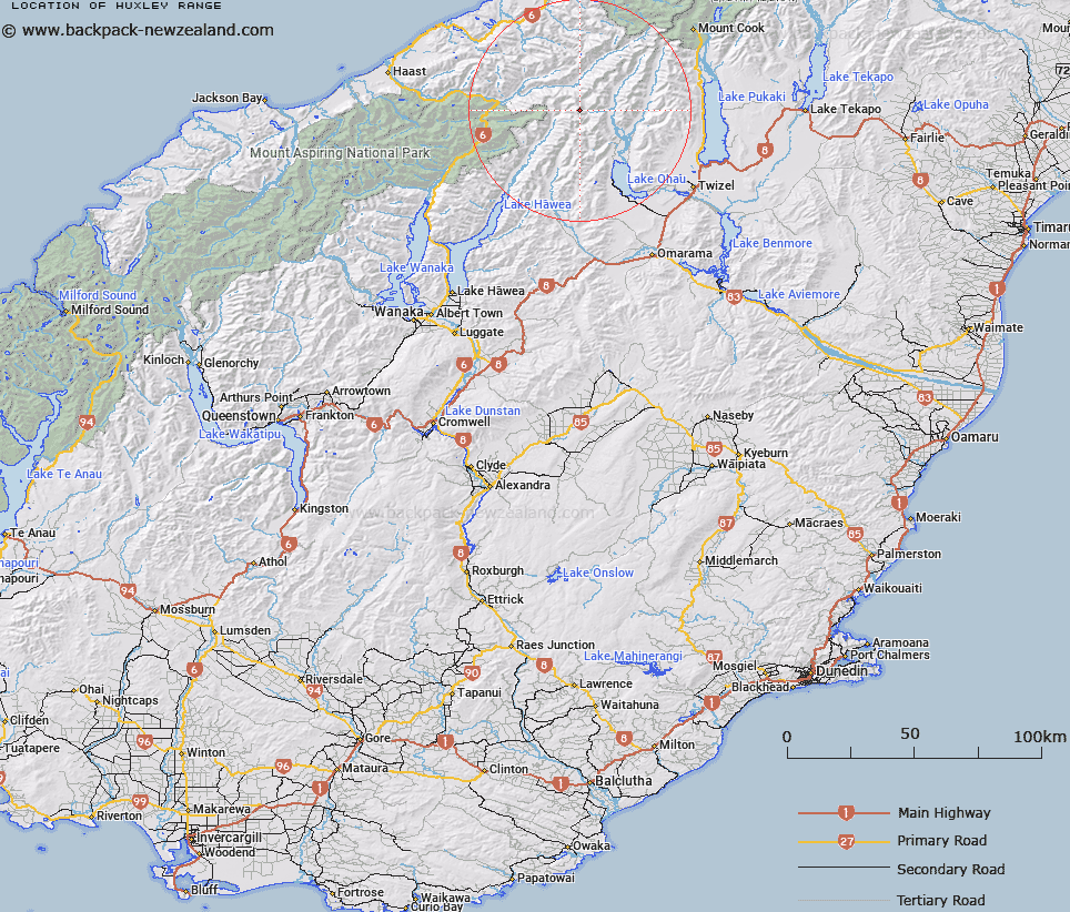
Map showing location of Huxley Range


LINZ description: Range, extending north north east from Leaning Mount at the south, through Mt Barth and Mt Huxley to Mt Strauchon at the north.
Latitude: -44.006674
Longitude: 169.70312
Northing: 5122100
Easting: 1335700
Land District: Otago
Feat Type: Range


Scroll down to see a more detailed road map and below that a topographical map showing the location of Huxley Range. The road map has been supplied by openstreetmap and the topographical map of Huxley Range has been supplied by Land Information New Zealand (LINZ).

Yes you can use the top static map for you school/university project or personal website with a link back. Contact me for any commercial use.

Huxley Range Map New Zealand


New Zealand places in our database
[ A ] [ B ] [ C ] [ D ] [ E ] [ F ] [ G ] [ H ] [ I ] [ J ] [ K ] [ L ] [ M ] [ N ] [ O ] [ P ] [ Q ] [ R ] [ S ] [ T ] [ U ] [ V ] [ W ] [ X ] [ Y ] [ Z ]


Closest 20 Ranges to Huxley Range

Solution Range ( 13.89km )   Bealey Range ( 14.01km )   Naumann Range ( 17.97km )   Neumann Range ( 17.97km )   The Black Hills ( 25.56km )   Ben Ohau Range ( 27.18km )   Barrier Range ( 27.88km )   Strachan Range ( 31.18km )   Rhoboro Hills ( 31.98km )   Ohau Range ( 33.02km )   Little Rhoboro Hills ( 33.77km )   Bannock Brae Range ( 33.9km )   Douglas Range ( 34.61km )   Bare Rocky Range ( 34.71km )   Young Range ( 36.18km )   Hooker Range ( 36.46km )   Thomas Range ( 38.63km )   Sealy Range ( 40.93km )   Collie Range ( 42.28km )   The Sierra Range ( 43.49km )   Mataketake Range ( 43.56km )   Karangarua Range ( 43.88km )   McKerrow Range ( 44.15km )   Diadem Range ( 44.32km )   Glissa Range ( 47.31km )   Mary Range ( 47.71km )   Marks Range ( 48.18km )   Mark Range ( 48.18km )   Aurora Range ( 49.98km )   Banks Range ( 50.35km )   Copland Range ( 50.82km )   Kirikirikatata / Mount Cook Range ( 51.46km )   Mount Cook Range ( 51.46km )   Aroarokaehe Range ( 51.78km )   Navigator Range ( 52.11km )   Old Man Range ( 52.71km )   Benmore Range ( 54.72km )   The Four Peaks ( 54.98km )   Browning Range ( 56.35km )   Balfour Range ( 56.76km )