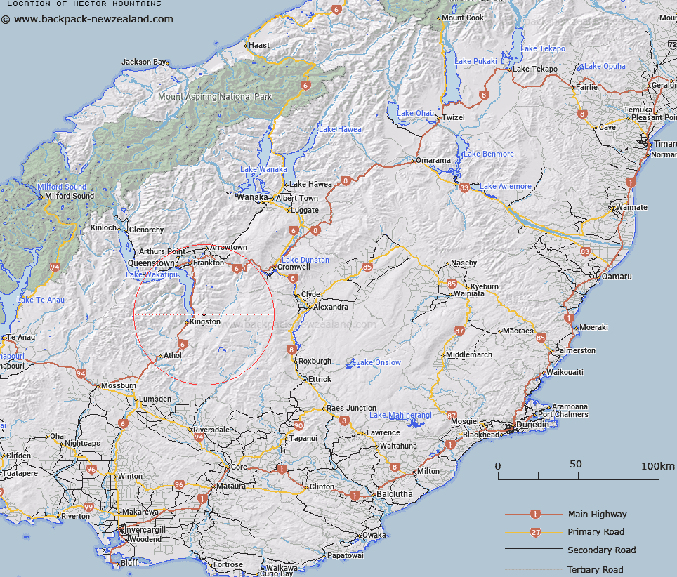
Map showing location of Hector Mountains
LINZ description: A major alpine range running north-south along the southern arm of Lake Wakatipu. NZTopo50 CC11-Queenstown, from GR 737 900 to NZTopo50 CD11-Kingston, GR 688 575. Alteration from Hector Mountains (former official geographic name) to a dual name and replacing New Zealand Gazette, 12 June 1980, No. 66, page 1752.
Latitude: -45.292717
Longitude: 168.813419
Northing: 4976000
Easting: 1271720.5
Land District: Otago
Feat Type: Range
Latitude: -45.292717
Longitude: 168.813419
Northing: 4976000
Easting: 1271720.5
Land District: Otago
Feat Type: Range

Scroll down to see a more detailed road map and below that a topographical map showing the location of Hector Mountains. The road map has been supplied by openstreetmap and the topographical map of Hector Mountains has been supplied by Land Information New Zealand (LINZ).
Yes you can use the top static map for you school/university project or personal website with a link back. Contact me for any commercial use.
[ A ] [ B ] [ C ] [ D ] [ E ] [ F ] [ G ] [ H ] [ I ] [ J ] [ K ] [ L ] [ M ] [ N ] [ O ] [ P ] [ Q ] [ R ] [ S ] [ T ] [ U ] [ V ] [ W ] [ X ] [ Y ] [ Z ]